
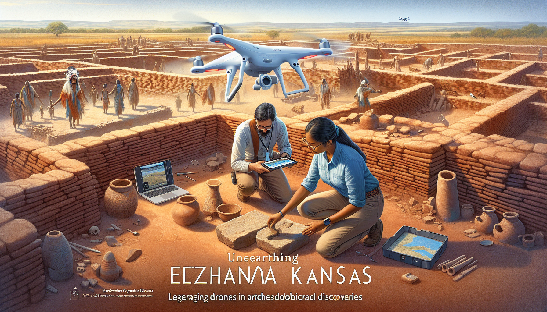
The unveiling of Etzanoa, an ancient Native American city located in present-day Kansas, marks a significant milestone in archaeological discoveries, particularly through the pioneering use of drone technology 1. Discovered by archaeologist Donald Blakeslee in 2015, Etzanoa’s revelation sheds light on the Wichita tribe that thrived in this area between 1450-1700 AD, offering newfound insights into their complex society and the rich history of the Great Plains region 1. The application of specialized drone-equipped cameras in unearthing Etzanoa Kansas underscores the evolving landscape of discovering ancient sites from above, enabling archaeologists to capture comprehensive aerial images that reveal patterns and features otherwise hidden from ground-level scrutiny 1.
This technological advancement in archaeology, exemplified by the Etzanoa Kansas discovery, not only delineates a significant leap in mapping ancient landscapes but also sets a precedent for documenting and preserving cultural heritage with precision and efficiency 1. As the exploration of Etzanoa continues, it stands as a beacon for future archaeological endeavors, leveraging drones in uncovering the mysteries of the past and enriching our collective understanding of ancient civilizations 1.
The Rise of Drones in Archaeology
In the evolving field of archaeology, drones, or unmanned aerial vehicles (UAVs), have emerged as indispensable tools due to their versatility and efficiency. Equipped with advanced cameras and sensors, these drones are capable of capturing high-resolution aerial imagery and collecting data, which can be used to generate three-dimensional models of archaeological sites 2. This capability marks a significant shift from traditional ground-based methods, offering a more efficient alternative that enables researchers to quickly survey large areas and capture detailed visual data 2. Furthermore, drones can operate in diverse terrains, providing access to challenging or inaccessible locations, thereby broadening the scope of archaeological exploration 2.
The application of drones in archaeology encompasses a wide array of technologies including high-resolution photo and video cameras, hyperspectral sensors, laser scanners, and thermal imagers 4. These tools facilitate a range of operations such as operational aerial photography, inspection, monitoring, recording, high-resolution imaging, and surveying objects in complex urban environments or enclosed spaces 4. Notably, drones equipped with photogrammetry software enable the creation of detailed three-dimensional models of sites, while lidar technology, exemplified by the DJI Zenmuse L1, can reveal objects concealed by vegetation, providing high levels of detail for mapping areas that are physically inaccessible for exploration 46. The versatility of drones, capable of being used as a standalone solution or in conjunction with traditional surveying techniques, underscores their transformative impact on archaeological research 5.
Drones have also significantly advanced the methods of site preservation and cultural heritage conservation. By offering a non-invasive means of exploration, drones minimize the risk of unintended destruction and help preserve the integrity of the cultural landscape 2. This technology captures imagery that reveals subtle variations in vegetation or soil conditions, indicating the presence of buried archaeological features, thereby aiding in the detection and documentation of new discoveries without the need for excavation 2. The use of drones for photogrammetry flight missions takes efficiency and accuracy to a new level, enabling archaeologists to plan for future dig sites, assess damage to ancient sites from natural disasters or human activity, and assist in the digital reconstruction of ancient sites 45. Through their ability to quickly cover large areas, access hard-to-reach locations, and capture high-resolution images and data, drones have become increasingly popular in archaeology and exploration, revolutionizing the way archaeological research is conducted and contributing to the preservation and conservation of cultural heritage 7.
Mapping Ancient Landscapes from Above
In the exploration of ancient landscapes, drones equipped with advanced technology have revolutionized the way archaeologists uncover and understand historical sites. Here are some of the key findings from recent drone surveys:
- Discovery of Undiscovered Settlements: A drone survey in Kansas, equipped with thermal cameras, unveiled an undiscovered Native American settlement, potentially part of the ancient Wichita town of Etzanoa, showcasing the power of thermal imaging in revealing hidden structures 9.
- Revealing Subterranean Structures: At the Blue Jay site in New Mexico, thermal imaging from drones helped identify subterranean house compounds that were not visible in visible light images, demonstrating the effectiveness of drones in uncovering underground features 10.
- Monumental Buildings and Earthworks: In Wash Paulo, Mexico, drones with thermal cameras revealed at least one large monumental building, although images taken at 4 a.m. showed significantly less detail, highlighting the importance of timing in thermal surveys 10. Similarly, a large earthwork approximately 30 meters across was revealed at Middle Grad Keep Creek, Illinois, not visible on the surface, and building foundations were uncovered at Enfield Shaker Village in Connecticut through thermal imaging 10.
The application of drones in archaeological surveys extends beyond discovery:
- Preservation and Conservation: Drones aid in the preservation and conservation of cultural heritage by identifying areas at risk of degradation or encroachment, offering a non-invasive means of exploration that minimizes the risk of unintended destruction 2.
- Detailed 3D Modeling: The creation of detailed three-dimensional models of archaeological sites by drones provides a clearer understanding of their spatial organization, enabling archaeologists to monitor environmental changes that may affect the sites 11.
- Interpretation of Data: While drones can capture imagery revealing subtle variations in vegetation or soil conditions, indicating the presence of buried archaeological features, the interpretation of this data requires expertise, underscoring the need for skilled analysis in drone surveys 12.
Drones have not only facilitated the discovery of ancient sites like Etzanoa Kansas but have also played a crucial role in mapping and understanding the spatial organization and environmental context of these sites. The non-invasive nature of drone surveys, combined with their ability to quickly cover large areas and capture high-resolution data, makes them an invaluable tool in the field of archaeology.
Read More: Drone Delivery: The Future of Logistics
Identifying Subsurface Features with Drone Technology
Drones equipped with Ground Penetrating Radar (GPR) and magnetic measurement systems have opened new avenues for identifying subsurface archaeological features, offering a glimpse into the hidden past without disturbing the soil. These advanced technologies have proven instrumental in revealing structures and objects buried beneath the earth’s surface, contributing significantly to our understanding of ancient civilizations.
Ground Penetrating Radar (GPR) Systems:
- Capability: GPR systems mounted on drones can detect variations in the electrical conductivity of different materials, enabling the identification of buried objects, structures, and even clandestine graves 17.
- Advantages: They offer the ability to navigate difficult terrains and conduct detailed surveys more frequently, monitoring changes in the subsurface environment over time 17. The DJI M600 Pro drone, equipped with a drone-based GPR system and enhanced by real-time kinematic (RTK) GPS, exemplifies the precision and autonomy achievable in archaeological research 22.
- Applications: Research involving simulated graves and cadavers has validated the performance of drone-based GPR systems, optimizing altitude, speed, and obstacle avoidance to minimize disturbance while locating subsurface features 22.
UAV-borne Magnetic Measurements:
- Challenges: While providing high-resolution data essential for archaeological prospection, UAV-borne magnetic measurements face calibration challenges and potential interference from external sources, necessitating careful handling and interpretation of data 12.
- Geometrics MagArrow: This lightweight, sensitive magnetometer system, designed for drone use, is particularly useful for detecting cultural features and mineralization, showcasing the adaptability of drones in archaeological surveys 6.
Thermal Imaging and Multispectral Data:
- Innovative Insights: The integration of thermal cameras and tetra cam sensors on drones allows for the detection of heat anomalies and stressed vegetation areas, which may indicate the presence of subsurface features obstructing root growth 23. This capability is crucial for identifying infilled areas, as the water retention levels of the soil impact vegetation, making it possible to identify these areas using near-infrared imagery 20.
- Broad Applications: Drones equipped with sensors capable of capturing visible light, infrared, thermal, radar, lidar, and hyperspectral images are revolutionizing the way archaeologists approach the exploration of ancient landscapes. These technologies not only reveal objects concealed by vegetation but also provide detailed information on archaeological features both on and below the ground surface 24.
The use of drone technology in identifying subsurface features has underscored the importance of continuous research and the adoption of new methods in archaeology. By offering a non-invasive means of exploration, drones minimize the risk of unintended destruction while providing valuable insights into past human activities 2. The potential of these technologies to revolutionize archaeological exploration is immense, opening up new possibilities for uncovering the mysteries of ancient civilizations.
Read More: Environmental Monitoring with Drones: Tracking Wildlife and Ecosystems
Documenting and Preserving Cultural Heritage
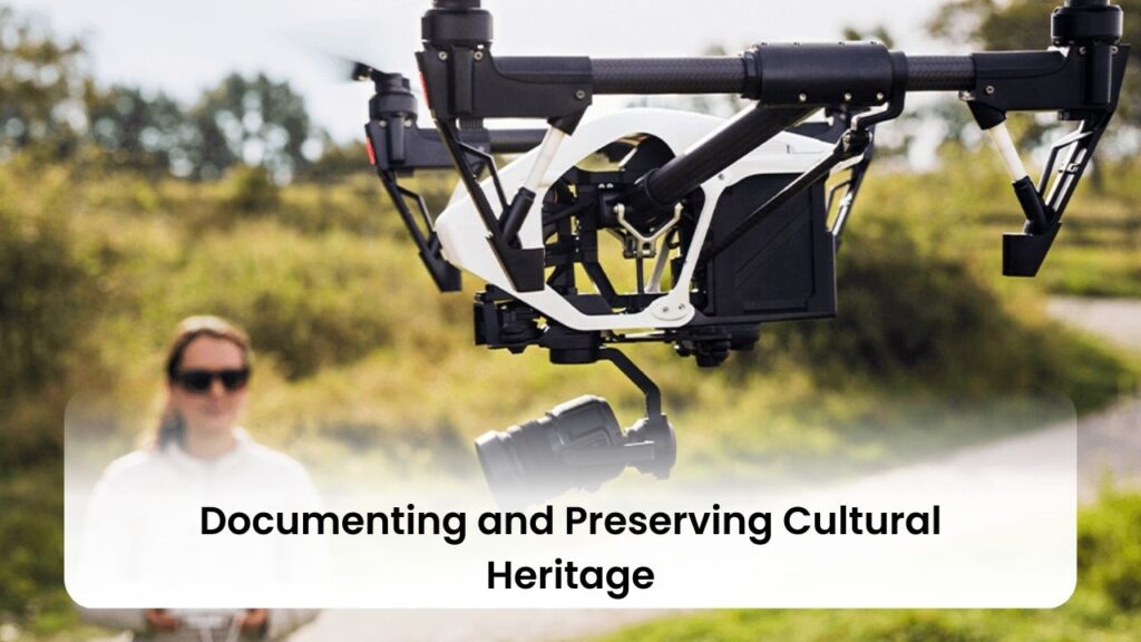
In the realm of archaeology, the role of drones in documenting and preserving cultural heritage has seen a remarkable evolution, offering a blend of precision, safety, and efficiency. Here’s a closer look at how drones are revolutionizing this critical aspect of archaeological work:
- High-Quality Aerial Imagery: Drones provide aerial photography that captures high-quality images of historical objects from various angles and at different times. This capability is particularly effective for studying both large and small objects, allowing for a comprehensive documentation process. The conversion of these aerial photographs into photogrammetric data further enables the building of detailed 3D models of historical sites, which are invaluable for both research and preservation purposes 6.
- Advantages Over Traditional Methods:
- Reduced Risks to Human Life: Drones minimize the need for human presence in potentially hazardous areas, ensuring safety while conducting surveys 27.
- Minimized Physical Contact: With drones, there’s significantly less risk of causing damage to fragile structures through physical contact, as their operation is entirely remote 27.
- Cost-Effectiveness: The operational costs associated with drone surveys are generally lower than those of traditional documentation methods, making it a financially viable option for many projects 27.
- Emerging Technologies and Case Studies:
- Technological Advancements: Recent improvements in drone technology, such as extended flight times, enhanced image stabilization, and the integration of artificial intelligence for automated image processing, have significantly boosted the efficacy of drones in archaeological documentation 27.
- Integration with Virtual and Augmented Reality: The potential for drones to work alongside virtual and augmented reality technologies opens up new possibilities for the interactive documentation and preservation of cultural heritage sites, offering immersive experiences that could revolutionize public engagement with archaeology 27.
- Notable Successes: Successful case studies include the mapping of archaeological sites in Italy and the creation of 3D models of ancient structures in Cambodia. These examples highlight the global applicability and effectiveness of drones in capturing the essence of cultural heritage sites for future generations 27.
Through these innovative approaches, drones are not only facilitating the meticulous documentation of cultural heritage but are also playing a pivotal role in ensuring its preservation. By harnessing the power of modern technology, archaeologists are able to safeguard the legacy of ancient civilizations with unprecedented accuracy and efficiency.
The Impact of Drones on Archaeological Exploration
Drones have significantly altered the landscape of archaeological exploration, bringing about a blend of opportunities and challenges. Their impact ranges from enhancing the efficiency of data collection to broadening the accessibility of archaeological sites, all while fostering public engagement and education.
- Enhanced Data Collection and Analysis:
- Drones expedite the archaeological survey process by covering large areas quickly and collecting data from various angles 5.
- The integration of technologies such as Ground Penetrating Radar (GPR) and magnetic measurement systems with drones has been pivotal in identifying subsurface features without disturbing the soil 1722.
- The ability to create detailed 3D models of archaeological sites using drone technology not only aids in the preservation efforts but also in the interpretation of ancient landscapes 7.
- Accessibility and Preservation:
- Drones enable access to remote and challenging terrains, making previously inaccessible locations available for research and documentation 5.
- They offer a non-invasive means of exploration, thus minimizing the risk of unintended destruction and preserving the integrity of the cultural landscape 2.
- By mapping ancient landscapes and structures, drones assist in identifying areas at risk of degradation or encroachment, enabling authorities to implement protective measures 2.
- Public Engagement and Education:
- The use of drones offers opportunities for public engagement by making archaeology more accessible to a broader audience 2.
- Case studies from various parts of the world, including Cuicuilco and El Salto in Mexico, and the Lower Chama Valley in New Mexico, showcase the global impact of drones in making archaeological discoveries more relatable and educational 8.
- Drones not only revolutionize our understanding of the past but also play a crucial role in educating the next generation of archaeologists, thereby ensuring the longevity of archaeological research and preservation efforts 7.
Despite their numerous advantages, it’s crucial to acknowledge that drones are not always revolutionary in archaeology. Some projects may use drones merely for obtaining bird’s-eye view snapshots, driven by the need to follow digital archaeology trends rather than to innovate or enhance the understanding of archaeological sites 3. Nonetheless, the discovery of a large circular earthwork at what may be Etzanoa, an ancestral Wichita site near Wichita, Kansas, through a Dartmouth-led study using multisensor drones, underscores the potential of drones to uncover significant archaeological findings 20.
Read More: Drones in Construction: Improving Site Surveying and Progress Tracking
Challenges and Limitations of Using Drones in Archaeology
While drones offer groundbreaking possibilities in archaeological exploration and the documentation of cultural heritage, they also come with a set of challenges and limitations that need careful consideration:
- Regulatory and Ethical Concerns:
- Regulatory Restrictions: Drones face strict regulatory restrictions that vary by region, impacting where and how they can be used in archaeological projects 27.
- Privacy Concerns: The potential invasion of privacy is a significant ethical issue, especially when drones are used near populated areas or sensitive sites 27.
- Respecting Local Communities: It’s crucial to engage with and respect local communities, acknowledging their cultural practices and the significance of the sites being documented 27.
- Operational and Technical Limitations:
- Skilled Operators Needed: The effective use of drones in archaeology requires operators with specialized skills, adding a layer of complexity and potential cost to projects 27.
- Adverse Weather Conditions: Drones are susceptible to adverse weather conditions, which can limit their operational days and affect the quality of data collected 27.
- Limited Flight Times: Due to restricted battery capacity, drones have limited flight times, which can be a significant constraint when mapping large areas 29.
- Line-of-Sight Requirement: For drone-based LiDAR and other technologies, maintaining a line-of-sight between the operator and the drone is essential, further restricting efficiency in large-scale mapping efforts 29.
- Data Integration and Quality:
- Ensuring Data Quality: One of the challenges includes guaranteeing the quality and reliability of the data collected by drones, which is essential for meaningful archaeological analysis 24.
- Technical Issues: Dealing with technical issues, such as calibration challenges for UAV-borne magnetic measurements, requires expertise and can impact the usability of the data 24.
- Integrating Drone Data: Another significant challenge is effectively integrating drone-collected data with other sources of information to provide a comprehensive understanding of archaeological sites 24.
Understanding these challenges is essential for archaeologists and cultural heritage professionals planning to incorporate drone technology into their work. By addressing these issues proactively, they can harness the full potential of drones while minimizing negative impacts and maximizing the benefits for archaeological discovery and documentation.
Case Studies: Successful Drone Surveys in Archaeology
Utilizing drones in archaeological research has proven to be an innovative approach to discovering and documenting ancient sites. Here are some notable case studies highlighting the successful application of drone technology in this field:
- Binghamton University’s Research in Louisiana and Missouri:
- Team Composition: Led by Professor Carl Lipo and Research Assistant Professor Timothy de Smet, this research group included anthropology doctoral candidate Petra Peretin, environmental studies major Jalissa Pirro, and geological sciences major Madison Tuohy 25.
- Objective: The primary goal was to explore and document archaeological features within these regions, utilizing drone technology to enhance the precision and efficiency of their research 25.
- Outcome: The use of drones allowed the team to quickly identify potential archaeological sites that warranted further investigation, significantly speeding up the target area exploration process 26.
- National Trust for Scotland’s Expedition:
- Location: Outlying Scottish Islands 4.
- Purpose: The mission aimed to scout and document archaeological sites across the islands, with a particular focus on uncovering the history and previously unknown traces of Bronze Age agriculture 4.
- Achievements: Drones equipped with advanced imaging technology provided detailed aerial views of the islands, revealing significant archaeological features that had remained hidden. This not only contributed to a deeper understanding of the islands’ historical landscape but also demonstrated the potential of drones in uncovering and preserving cultural heritage 4.
- Advantages of UAV in Archaeological Exploration:
- Efficiency in Exploration: Drones can cover large areas in a short amount of time, making it easier to determine if a site has archaeological features that require excavation 26.
- Non-Invasive Methodology: UAV technology offers a way to explore potential archaeological sites without disturbing the landscape, preserving the integrity of the sites for future detailed investigation 26.
- Enhanced Documentation: High-resolution aerial imagery captured by drones provides invaluable data for documenting sites, which is crucial for both research and preservation purposes 26.
These case studies showcase the transformative impact of drones on archaeological exploration, from the initial identification of sites to the detailed documentation and preservation of cultural heritage. As technology continues to evolve, the role of drones in archaeology is set to become even more significant, opening up new possibilities for uncovering the mysteries of our past.
Read More: Drones in Emergency Response: Assisting Firefighters and Emergency Services
Educating the Next Generation of Archaeologists
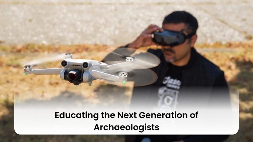
In the quest to educate the next generation of archaeologists, the integration of drone technology into the curriculum is proving to be a game-changer. This transformation is not just about adopting new tools but about reshaping the very approach to archaeological exploration and preservation. Here’s a closer look at how drones are being leveraged in archaeological education:
- Real-World Applications of Drone Technology:
- Operational Aerial Photography and Monitoring: Students learn to conduct aerial surveys, capturing images that unveil hidden structures and patterns within ancient settlements 4.
- High-Resolution Imaging and Urban Development Surveys: The curriculum includes training on using drones for detailed imaging and analysis, essential for urban archaeology and the study of historical cityscapes 4.
- Photogrammetric Data Conversion: A critical skill taught is converting aerial photographs into photogrammetric data, which is invaluable for creating detailed 3D models of archaeological sites 4.
- Environmental Impact Assessment: Aspiring archaeologists are educated on utilizing drones to assess the environmental impact on archaeological sites, ensuring sustainable exploration practices 4.
- Hands-On Experience:
- The hands-on experience with drones provides students with a practical understanding of how these tools can be applied in real-world scenarios. This approach not only enhances their technical skills but also fosters a deeper appreciation for the interdisciplinary nature of archaeology, blending technology with historical inquiry 19.
- Case Study: Analyzing an Ancestral Wichita Settlement:
- A focal point of the educational curriculum is the study of an ancestral Wichita settlement in southeastern Kansas. By focusing on a potential council circle, students gain insights into the use of space and architecture in ancient settlements 30.
- This case study exemplifies how drones can be used to uncover and interpret subsurface features without the need for intrusive methods, preserving the site’s integrity while providing valuable data for analysis 30.
By integrating drone technology into the education of future archaeologists, the field is witnessing a paradigm shift. Not only does this approach equip students with advanced technical skills, but it also broadens their perspective on archaeological exploration, encouraging innovative and sustainable practices. For those interested in incorporating drone surveys into their projects or curriculums, engaging with relevant specialists is crucial for tailoring the technology to specific educational or research objectives 5.
Explore More Categories:
Conclusion
Throughout the exploration of Etzanoa in Kansas and the broader application of drones in archaeology, we have witnessed a transformative shift in how ancient landscapes are discovered, documented, and preserved. The innovative integration of drone technology, from aerial photography to Ground Penetrating Radar (GPR) systems, has not only expedited the survey process but has also opened new avenues for identifying subsurface features without disturbing the soil. These capabilities have significantly enhanced the efficiency of archaeological exploration, contributing to a more nuanced understanding of ancient civilizations and ensuring the integrity of these priceless cultural landscapes.
As the field of archaeology continues to embrace drone technology, the implications for future research, education, and the preservation of cultural heritage are immense. The case studies highlighted within this article showcase the successful application and impact of drones, underscoring the potential for these tools to revolutionize both the methodology and accessibility of archaeological exploration. By fostering a digital evolution in archaeology, we edge closer to unraveling the mysteries of the past, safeguarding our shared heritage, and educating the next generation of archaeologists in these advanced, non-invasive techniques.
FAQs
How Are Drones Utilized in Archaeological Research?
Drones have become invaluable tools in the field of archaeology, serving several key functions. They are employed to document and record newly discovered sites, aid in the strategic planning of upcoming excavation projects, and evaluate the extent of damage inflicted on ancient sites by natural disasters or human interference.
Can You Visit the Once-Lost City of Etzanoa in Kansas?
Yes, the ancient city of Etzanoa, situated on the scenic bluffs at the meeting point of the Walnut and Arkansas rivers, is now accessible for public tours. Interested individuals can book a tour for a fee of $10 per person through the Cherokee Strip Land Rush Museum. The museum also features a documentary that chronicles the discovery of Etzanoa.
What is the Historical Significance of Etzanoa Found in Kansas?
Etzanoa, a significant archaeological site in present-day Arkansas City, Kansas, was a thriving city of the Wichita people. Located near the Arkansas River, it existed from around 1450 to 1700. Spanish explorers who visited the site referred to it as “the Great Settlement,” and it is believed to have been home to approximately 20,000 Wichita inhabitants at its peak.
What Was the Estimated Population of Etzanoa?
Etzanoa, encountered by Spanish explorers during their journey from New Mexico to Kansas, was believed to have a population of around 20,000 people. This large indigenous settlement is part of the rich history of the Wichita people, highlighted through various accounts and maps from the period, including those by captives such as Miguel, a native Wichita.
References
[1] – https://www.sciencedaily.com/releases/2020/09/200903162038.htm [2] – https://www.womenwhodrone.co/single-post/the-role-of-drones-in-archaeology-mapping-ancient-landscapes-from-above [3] – https://www.mdpi.com/journal/drones/special_issues/archaeological_UAV [4] – https://www.aeromotus.com/industry/the-use-of-professional-drones-in-archaeological-research/ [5] – https://www.landform-surveys.co.uk/news/drones-heritage-the-rise-of-drone-technology-in-archaeology/ [6] – https://www.linkedin.com/pulse/use-professional-drones-archaeological-research-aeromotus [7] – https://medium.com/@shubham.0304patel/how-drones-are-being-used-in-archaeology-and-exploration-afc5fee378af [8] – https://core.tdar.org/collection/29462/archaeological-applications-of-unmanned-aerial-systems-drones [9] – https://coptrz.com/blog/blog-surveying-drone-survey-unveils-an-undiscovered-settlement/ [10] – https://www.youtube.com/watch?v=H-3N1rWtQVc [11] – https://www.linkedin.com/pulse/mapping-unseen-drones-archaeological-discoveries?trk=public_post_main-feed-card_feed-article-content [12] – https://journals.openedition.org/archeosciences/9645 [13] – https://par.nsf.gov/servlets/purl/10209663 [14] – https://anthropology.dartmouth.edu/news/2020/10/drone-survey-reveals-large-earthwork-ancestral-wichita-site-kansas [15] – https://www.ancient-origins.net/news-history-archaeology/kansas-earthwork-0014217 [16] – https://www.bluefalconaerial.com/uncovering-hidden-treasures-how-lidar-drone-scanning-is-changing-archaeology/ [17] – https://drones.measurusa.com/blogs/news/drone-based-ground-penetrating-radar-for-advanced-underground-mapping [18] – https://news.uchicago.edu/story/drones-bring-new-dimension-archaeology [19] – https://www.youtube.com/watch?v=iLnmk33UxcM [20] – https://phys.org/news/2020-09-drone-survey-reveals-large-earthwork.html [21] – https://www.sciencenews.org/article/drones-native-american-settlement-etzanoa-kansas-pasture [22] – https://www.ncbi.nlm.nih.gov/pmc/articles/PMC10459563/ [23] – https://www.youtube.com/watch?v=viAcoH9HliY [24] – https://www.linkedin.com/advice/0/how-can-drone-remote-sensing-used-explore-hidden-archaeological-nbehc [25] – https://www.binghamton.edu/news/story/4054/eye-in-the-sky-drones-play-important-role-in-archaeological-research [26] – https://onlinelibrary.wiley.com/doi/10.1002/arp.1569 [27] – https://www.researchgate.net/publication/333663976_The_Use_of_UAVs_for_Cultural_Heritage_and_Archaeology [28] – https://arstechnica.com/science/2020/09/archaeologists-with-drones-discover-pre-columbian-earthworks-in-kansas/ [29] – https://www.researchgate.net/publication/326072454_LiDAR_from_drones_employed_for_mapping_archaeology_-_Potential_benefits_and_challenges [30] – https://www.academia.edu/43948240/A_Council_Circle_at_Etzanoa_Multi_sensor_Drone_Survey_at_an_Ancestral_Wichita_Settlement_in_Southeastern_Kansas