
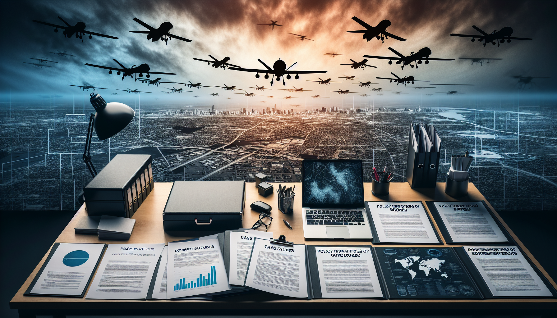
The Federal Aviation Administration (FAA) projects a significant increase in the deployment of government drones, anticipating the commercial drone fleet to reach 828,000 and the recreational fleet to number approximately 1.48 million by 20241. This uptick underscores the growing reliance on drones for various governmental operations, highlighting the necessity for robust regulatory frameworks. The FAA’s endeavors to seamlessly incorporate drones into the national airspace system— alongside manned aircraft—demonstrates a forward-thinking approach to address the intricate balancing act of innovation and safety, utilizing seven designated drone test sites for research flights since 20152. However, the task is formidable, with hurdles such as enhancing the drone traffic management system and navigating the complexities of legal, technical, and policy questions that arise with the increased government use of drones3.
As governments navigate these challenges, privacy and jurisdictional matters remain contentious. Privacy advocates push for stringent legislative measures that would limit the use of drones by the government to scenarios where a warrant is obtained in advance, amplifying the debate over surveillance and individual liberties4. So far, thirteen states have enacted laws regulating law enforcement’s use of drones, with eleven requiring a warrant for deployment5. Moreover, comparisons between the capabilities and operational costs of manned versus unmanned aircraft reveal drones as less capable and more expensive, yet their potential for extensive surveillance at lower operational costs raises significant concerns among privacy proponents67. These dynamics underscore the critical balance that must be struck between leveraging technological advancements for public good and safeguarding civil liberties, setting the stage for a comprehensive exploration of policy implications tied to the government’s use of drones.
The Evolution of Drone Technology in Governance
- Early Developments and Government Initiatives
- The inception of drone technology dates back to 1849, with Austrian soldiers employing balloons filled with explosives in an attack on Venice, marking the first recorded use of unmanned aerial vehicles (UAVs) in warfare 3.
- The evolution continued with the development of the first pilotless winged aircraft, the Ruston Aerial Target, by Britain in 1916, a significant advancement in UAV technology 3.
- The U.S. military’s use of drones for mapping and surveying enemy territories during the Korean War further showcased the strategic importance of UAVs in modern warfare and reconnaissance 3.
- Recognizing the potential of drones beyond military applications, the U.S. government, under President Obama’s directive in February 2015, mandated federal agencies to consider privacy implications as they integrate UAVs into their operations, highlighting a commitment to responsible drone use 2.
- This was further supported by the White House Office of Science and Technology Policy’s announcement in August 2016, encouraging the adoption of UAVs across various sectors in the U.S., aiming to foster innovation while addressing regulatory and privacy concerns 1.
- Commercial Adoption and Regulatory Challenges
- The early 2000s marked the beginning of commercial drone usage by government agencies for purposes such as disaster relief and fighting wildfires, demonstrating the versatility of drones in public service 3.
- Despite their potential, commercial use of drones in the United States was not approved until 2013, with regulatory barriers significantly slowing their widespread adoption 4.
- The Federal Aviation Administration (FAA) has since been working to overcome these barriers, granting blanket exemptions for drone use under specific conditions, though guidelines for flying beyond the line of sight remain unclear, reflecting ongoing challenges in drone regulation 4.
- The collaborative effort to create an institutional infrastructure for drone technology involves entrepreneurs, regulators, and other stakeholders, highlighting the multi-faceted approach required to fully integrate UAVs into society 4.
- Data Collection and Management
- Drones have the capability to collect data at an impressive rate of 1.5GB per minute, with a resolution of 1 centimeter per pixel, showcasing their potential for detailed surveillance and analysis 5.
- This data encompasses more than just video; it includes various kinds of data and analytics processing, necessitating specialized skills for effective utilization 5.
- With the FAA forecasting 2.4 million drones for commercial purposes by the end of 2017, the volume of sensor data entering the corporate world underscores the need for robust governance policies and data management practices to ensure regulatory compliance and privacy protection 5.
Key Drivers for Government Adoption of Drones
The adoption of drones by government agencies is driven by a multifaceted array of benefits and strategic initiatives, as outlined below:
- Strategic Initiatives and Funding:
- The U.S. government has earmarked $35 million in research funding over five years for advancements in drone technology, focusing on design, control, and application across various fields such as electric transmission line inspection, agriculture monitoring, and severe storm study 1.
- Acceleration of airspace integration research and the expansion of federal agencies’ use of UAVs demonstrate a strong commitment to integrating this technology into national operations 1.
- Regulatory Framework and Economic Impact:
- The FAA has established nationwide guidelines for the operation of commercial uncrewed aircraft weighing under 25 kg, allowing for flights below 122 m and within sight of their operators for commercial, scientific, public, and educational purposes 1.
- Despite current restrictions, such as the prohibition of UAV package delivery services, the potential economic impact over the next decade is substantial, with projections suggesting that commercial uncrewed aircraft systems could generate more than $82 billion for the U.S. economy and support up to 100,000 new jobs 1.
- Technology and Application:
- Drones serve as efficient data collection devices, capable of gathering data more effectively and at a lower cost than traditional methods. This includes carrying various kinds of sensors like cameras, infrared sensors, and LIDAR sensors, which are crucial for applications in public services such as police, firefighting, disaster response, and environmental monitoring 68.
- The need for processing capability to manage the data collected by drones emphasizes the technological components essential for their operation: the drone vehicle, sensors or payload, and processing capability 6.
- The affordability and efficiency of drone technology make it a valuable tool for enhancing law enforcement efficiency, even for smaller agencies, and its use in the public services sector underscores its safety, speed, and cost-effectiveness compared to traditional methods 78.
The integration of drones into government operations is not just about adopting new technology; it’s about reshaping how public services are delivered, enhancing efficiency, and opening new avenues for economic growth. The strategic investment in drone technology, coupled with a developing regulatory framework and the broad application across various sectors, positions drones as pivotal tools in the future of governance and public service delivery.
Case Study 1: Emergency Response and Disaster Management
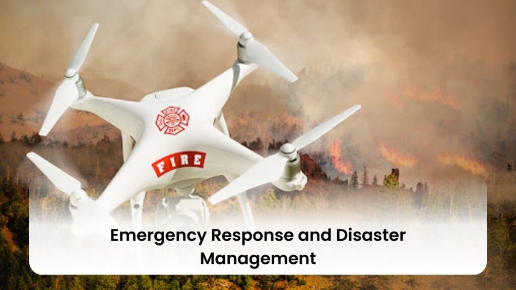
Unmanned Aerial Vehicles (UAVs), commonly known as drones, have revolutionized emergency response and disaster management by offering unique advantages that traditional methods cannot match. Their rapid deployment, flexibility, and ability to provide real-time data make them indispensable in crisis situations. Below are key instances where drones have significantly contributed to disaster management efforts:
- Nepal Earthquake, 2015 & Hurricane Harvey, 2017:
- Rapid Damage Assessment: In the aftermath of the Nepal earthquake, drones were swiftly deployed to assess the damage. Their high-resolution imagery was instrumental in mapping the destruction and identifying safe routes for aid delivery 9.
- Flood Monitoring and Rescue Operations: During Hurricane Harvey, drones monitored flood levels, assessed infrastructure damage, and aided in rescue operations. The real-time data they provided was crucial for emergency responders in prioritizing areas needing immediate attention 9.
- California Wildfires, 2018 & Floods in Indian States, 2018-2022:
- Fire Progression Monitoring: UAVs played a vital role in the California wildfires by monitoring fire progression, identifying hotspots, and assessing damage to property and natural resources. This enabled firefighters to strategize and respond more effectively 9.
- Locating Missing Individuals: In the floods that affected various Indian states, drones were used to locate missing individuals and assess the extent of damage. The real-time information provided to rescue teams enabled them to save lives and plan their operations more effectively 9.
- Technological and Operational Advantages:
- Data Integration and Analysis: The effectiveness of UAVs lies not just in data collection but also in the integration and analysis of this data. Robust data processing frameworks and skilled personnel are essential for real-time interpretation of the data collected, making drones a powerful tool for emergency services 9.
- Preventative Maintenance: Drones are also used for preventative maintenance projects, such as identifying potential risk zones and planning evacuation routes in areas prone to slips or earthquakes. This proactive approach can significantly mitigate the impact of potential disasters 10.
Drones have proven their worth in various disaster scenarios, from monitoring building stability after Hurricane Katrina to detecting forest fires and aiding in search and rescue operations. Their ability to provide valuable information for first responders, such as the passability of roads and the condition of paths, has become an integral part of disaster response strategies 13. The use of drones for constant monitoring of structures susceptible to collapse, such as mine tailings, underscores their potential in preventing disasters before they occur 13.
In summary, the deployment of drones in emergency response and disaster management showcases their indispensable role in enhancing situational awareness, improving response times, and ensuring the safety of both the affected populations and the emergency personnel involved. Their adaptability to different scenarios, coupled with the benefits of rapid assessment, access to remote areas, and cost savings, positions drones as pivotal tools in the future of disaster response and public safety operations 12.
Case Study 2: Environmental Monitoring and Conservation Efforts
In the realm of environmental monitoring and conservation efforts, drones have emerged as a transformative tool, offering unparalleled capabilities in data collection and analysis. Their application ranges from tracking endangered species to monitoring air quality over industrial complexes. Here, we delve into two distinct case studies that illustrate the versatility and efficacy of drones in environmental conservation:
Case Study: Monitoring Endangered Species in Ecuador
- Species Monitored: Brown-headed spider monkeys, a critically endangered species 14.
- Drone Used: E384 from Event 38, equipped with a Canon SX 260HS for capturing high-resolution images and topography data 14.
- Area Covered: Five blocks of land, totaling 1000 hectares, surveyed in two days 14.
- Data Output: An orthomosaic of the area with a ground sample distance (GSD) of eight centimeters and a topographical model, providing enhanced visibility in areas difficult to survey on foot 14.
- Efficiency and Cost: A traditional survey would have taken significantly longer, but the E384 accomplished it in just two days, presenting an affordable solution that allows for more funds to be allocated towards direct conservation efforts 14.
Case Study: Air Quality Monitoring in South Korea
- Location: Two industrial complexes in Busan and Daejeon, South Korea 15.
- Methods Tested: High-resolution orthoimagery and atmospheric sensors for monitoring air pollutants 15.
- Data Analysis:
- High-resolution orthoimagery enables detailed examination of facilities with a ground sample distance of 5 cm 15.
- Atmospheric sensors facilitate mapping of air quality through spatial analysis, crucial for preventing environmental contamination and illegal activities by pollutant-emitting facilities 15.
Broader Applications of Drones in Environmental Monitoring
- Scope of Use: Drones are increasingly utilized for vegetation monitoring, plant and animal counting, species identification, water management, risk management, progress monitoring, land management, and search and rescue 16.
- Data Outputs: Include orthomosaic maps, index maps, digital surface models, 3D mesh maps, point clouds, and contour lines, processed using software such as eMotion, PIX4Dfields, PIX4Dmapper, PIX4Dmatic photogrammetry software, and Measure Ground Control 16.
- Government Deployment: The Interior Department employs UAVs in 25 different mission areas, including mapping, 3D mapping and imaging, disaster relief, search and rescue, and surveillance. Their fleet of 563 drones has completed missions in one-seventh the time and at one-tenth the cost of manned aircraft missions 16.
These case studies underscore the pivotal role of drones in enhancing the efficiency and effectiveness of environmental monitoring and conservation efforts. By providing detailed data at unprecedented speeds and reduced costs, drones are not only reshaping the landscape of environmental science but also offering a promising avenue for safeguarding our planet’s natural resources and biodiversity.
Case Study 3: Infrastructure Inspection and Urban Planning
Drones equipped with advanced imaging technologies, such as cameras and LiDAR, are revolutionizing the field of infrastructure inspection and urban planning. These technologies enable the capture of detailed images and 3D data, facilitating the creation of digital twins of structures, even in areas that are traditionally inaccessible. The integration of Artificial Intelligence (AI) algorithms further enhances this process by analyzing the captured data to detect structural issues like cracks and corrosion. This innovative approach allows for real-time monitoring of infrastructure, early identification of potential problems, and efficient planning of maintenance activities. The benefits of utilizing drones in this context are manifold:
- Efficiency and Safety: Inspections become faster and more secure, significantly reducing costs and risks associated with traditional inspection methods 17.
- Precision and Detail: Skydio drones, for example, can navigate challenging areas with ease, capturing crisp, detailed imagery that allows for sub-millimeter precision in inspections 17.
- Data Processing and Reporting: Tools like Skydio 3D Scan automate the capture of image sets, generating 2D maps and 3D models that facilitate digital twin workflows. This helps in spotting defects sooner and making better maintenance decisions. Similarly, Pix4D offers an end-to-end solution for executing efficient drone flights, acquiring relevant data, and transforming it into highly accurate 3D models. AI algorithms then examine the assets, providing contextualized images that highlight, annotate, and categorize critical elements. The process culminates in the generation of a ready-to-share report with a single click, streamlining the inspection process and reducing manual effort 17.
The impact of drones on infrastructure maintenance and urban planning is further exemplified by innovative applications around the globe:
- Case Study: Bridge and Tower Inspections in India: The use of drones equipped with AI and digital twin technology is set to revolutionize the way bridge and tower inspections are conducted. This approach enhances efficiency, safety, and accuracy, ensuring a sustainable future for infrastructure maintenance 17.
- Innovative Repair Solutions: The Leeds University Engineering Department has designed drones capable of fixing potholes in roads. This highlights the potential of drones not only in inspection and data collection but also in actively contributing to infrastructure maintenance 8.
In summary, the adoption of drone technology in infrastructure inspection and urban planning offers a promising avenue for enhancing the efficiency, safety, and accuracy of maintenance operations. By leveraging advanced imaging technologies, AI algorithms, and innovative applications, drones are set to play a pivotal role in shaping a sustainable future for urban infrastructure.
Legislation, Ethics, and Public Perception
- Legislation and Ethical Principles:
- Governments worldwide deploy drones for a variety of purposes including border control, criminal investigations, and public assembly monitoring. The ethical use of drones by police, particularly when considering armed drones, is guided by principles of necessity, proportionality, and precaution18.
- Concerns regarding privacy and the potential for undue intimidation highlight the need for careful consideration of drone use in policing. These concerns have led to calls for legislation requiring government agencies to obtain warrants before deploying drones218.
- Several states have enacted laws to regulate law enforcement’s use of drones, focusing on the technology rather than addressing potential harms. This approach has led to inconsistencies, where sophisticated surveillance technologies in manned aircraft are permitted, while benign drone uses are restricted2.
- Public Perception and Moral Considerations:
- The public’s perception of drone strikes, whether tactical or strategic, and the measures taken to prevent civilian casualties, significantly influence the moral legitimacy attributed to these actions19.
- Moral norms and considerations play a crucial role in shaping public opinion on the legitimacy of drone use, indicating the importance of transparent and constrained drone operations19.
- Privacy, Research, and Regulatory Challenges:
- Privacy implications are a significant concern, with advocates pushing for stringent controls on drone use unless a warrant is obtained. This stance is supported by the enactment of drone-related legislation in thirteen states, with eleven requiring a warrant for government drone use2.
- The ethical and regulatory issues surrounding inadvertent data collection by drones during research emphasize the need for community consultation and steps to protect privacy20.
- Challenges in regulating drones include developing a comprehensive drone traffic management system and addressing legal and technical questions. The FAA’s efforts to integrate drones safely into national airspace highlight the ongoing need for education and communication with local law enforcement23.
- Despite these efforts, policy limitations and the illegal status of interfering with drone radio frequency in the U.S. present significant hurdles. A proposal for the creation of a policy advisory group suggests a path forward for local and regional officials to counter unauthorized drone activities21.
These points underscore the complex landscape of drone legislation, ethics, and public perception, highlighting the need for balanced policies that consider technological capabilities, privacy concerns, and ethical principles in the governance and use of drones.
Technological Limitations and Security Concerns
Drones, while offering numerous benefits for commercial and government use, present a set of technological limitations and security concerns that cannot be overlooked. These challenges range from operational disruptions to potential threats to public safety and national security.
Operational and Safety Concerns:
- Airport Disruptions: Drones have the potential to disrupt airport operations, leading to financial losses and safety hazards. Instances of drones flying too close to airports have resulted in temporary shutdowns and delays, highlighting the need for stricter regulations and detection systems 21.
- Security Evasion: Unlike traditional security measures, drones can easily elude security cameras and physical barriers. Their ability to exploit data through various means poses a significant cybersecurity threat, especially to facilities holding sensitive information 21.
- Need for Test Ranges: To ensure the safety and efficacy of counter-drone technology, more test ranges are essential. These facilities would allow for the thorough testing of countermeasures before they are deployed in public or sensitive areas, minimizing risks associated with untested technologies 21.
Security Threats and Unauthorized Activities:
- Contraband Smuggling: Drones have been used to smuggle contraband into prisons, endangering inmates, staff, and the surrounding community. Similarly, smugglers have utilized drones to transport drugs across international borders, bypassing traditional security measures 21.
- Surveillance and Espionage: Unauthorized drones can conduct illegal surveillance, invading personal privacy, or be used for espionage, collecting sensitive information for malicious purposes. This raises significant concerns about privacy rights and national security 21.
- Weaponization and Cyberattacks: The potential for drones to be used as weapons, either by carrying explosives or for chemical, biological, or radiological attacks, poses a direct threat to public safety. Additionally, drones can be employed for cyberattacks, exploiting vulnerabilities in critical infrastructure systems and networks 21.
Recommendations for Mitigation:
- Education and Training: Enhancing U.S. educational systems with drone programs could connect students with professionals in the defense and commercial markets. This would not only provide opportunities for post-graduate employment but also advance counter-UAS missions by developing skilled personnel capable of addressing these challenges 21.
- Safety Education: To mitigate risks associated with drone operation, comprehensive safety education is necessary. Awareness programs can inform operators about the potential hazards of drones and promote responsible usage 22.
In summary, while drones offer promising applications in various fields, addressing the technological limitations and security concerns associated with their usage is paramount. Through a combination of regulatory measures, technological advancements, and educational initiatives, it is possible to harness the benefits of drones while minimizing the associated risks.
Future Directions: AI Integration and Autonomous Operations
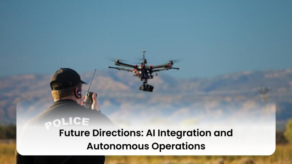
The integration of Artificial Intelligence (AI) and the development of autonomous operations in drone technology mark a significant shift in both military applications and commercial sectors. The advancements in this field are rapidly evolving, with significant implications for future warfare, industry applications, and ethical considerations.
Military Applications and Developments:
- The Pentagon’s Replicator initiative is set to deploy thousands of autonomous weapons systems, including drones, across multiple domains within the next 18 to 24 months, signaling a substantial leap in military capabilities 25.
- These advancements have been notably demonstrated in the Russia-Ukraine War, where drones with autonomous capabilities and AI-enabled munitions played a critical role on the battlefield 25.
- The emergence of lethal autonomous weapons systems (LAWS) that can identify, track, and attack targets without human intervention is reshaping warfare, with drones denying adversaries air superiority and providing a decisive military advantage 25.
- AI-enabled drone swarms are expected to replace discrete drone strikes, working in coordination to destroy critical infrastructure and other targets, posing new risks to civilians and complicating the targeting cycle 25.
Commercial Sector Innovations:
- The drone market is witnessing significant growth, with applications expanding into medical, logistics, and agriculture sectors. Current commercial drones can carry up to 2.5 pounds, but developments like Amazon’s drone aim to carry up to 5 pounds, indicating an increase in their use and capabilities 27.
- Engineers are exploring alternative power sources such as hydrogen engines to overcome limitations imposed by lithium batteries, enhancing load-carrying capacity and flight time 27.
- AI is enabling drones to fly autonomously, making decisions based on their environment, with swarming technology allowing multiple drones to work together, reducing costs and increasing efficiency for businesses 27.
Challenges and Ethical Considerations:
- As AI reduces human involvement in drone operations, warfare becomes less explainable and transparent, raising concerns about the accountability and ethical implications of AI-generated outcomes 25.
- The unpredictable nature of AI complicates efforts to discern the right course of action, with the morally optimal laws possibly not being legal or wise, highlighting the complex ethical landscape surrounding autonomous systems 25.
- The U.S. is seeking to set international norms for the responsible military development of AI, with initiatives like the Political Declaration on Responsible Military Use of AI gathering signatories, aiming to address these challenges 26.
In summary, the future directions of AI integration and autonomous operations in drones are characterized by rapid advancements in military applications, expanding commercial uses, and emerging ethical challenges. These developments necessitate careful consideration of the implications for warfare, industry, and society as a whole.
Conclusion
Throughout this comprehensive exploration, we have delved into the multifaceted impacts and implications of drone technology across governmental, environmental, infrastructural, legislative, and future technological landscapes. The strategic deployment of drones by government agencies for emergency responses, environmental conservation, and urban planning showcases their transformative potential in enhancing efficiency, safety, and data collection capabilities. These advancements underscore the crucial balance between innovation and privacy, the significance of robust regulatory frameworks, and the emerging ethical considerations as drone technology continues to evolve.
Looking forward, the integration of Artificial Intelligence (AI) and autonomous operations presents both unparalleled opportunities and novel challenges across military and commercial domains. As drones become more entrenched in our societal fabric, it is imperative to address their technological limitations, security concerns, and ethical implications comprehensively. By fostering a collaborative approach among policymakers, technologists, and the public, we can leverage the benefits of drone technology while safeguarding civil liberties and ensuring ethical use, thus shaping a future where drones contribute positively to societal advancement and global well-being.
FAQs
- What constitutes an Unmanned Aircraft System (UAS)?
- An Unmanned Aircraft System encompasses the unmanned aircraft itself along with the equipment necessary for its safe and efficient operation29.
- Is registration required for all drones/UAS?
- What are the consequences of failing to register a UAS?
- The FAA may impose civil penalties up to $27,500. Criminal penalties can include fines up to $250,000 and/or imprisonment for up to three years29.
- Do I need to carry my FAA registration certificate while operating a UAS?
- Yes, federal law mandates that you must have your FAA registration certificate in your possession when operating your unmanned aircraft29.
- Why is UAS registration important?
- Registration aids the FAA in ensuring safety for the operator, others on the ground, and manned aircraft. It addresses security and privacy challenges by making UAS traceable in the event of an incident and facilitates the return of lost UAS29.
- Are there exemptions to the UAS registration requirement?
- UAS operated exclusively under Public Law 112-95 Section 336, often related to hobbyist activities within visual line-of-sight and not for commercial purposes, are currently exempt from registration30.
- Requirements for Operating a UAS for Business Purposes:
- Refer to the Small UAS rule (Part 107) for a regulatory framework, which includes obtaining a Remote Pilot Certificate, Operational Waiver, or Airspace Authorization from the FAA30.
- Advanced Facility Mapping and Flight Restriction Visualization:
- The FAA provides an ArcGIS site to aid in visualizing flight restrictions and planning safe operations30.
- Qualifying for a Remote Pilot Certificate:
- Part 61 pilot certificate holders can qualify by completing an online UAS knowledge course instead of the aeronautical knowledge test, provided they have completed a flight review within the past 24 months30.
- University UAS Flight Regulations:
- Flights must have a nexus to the university’s mission, be approved in advance, and adhere to safety limits set by the university. Unapproved flights should be reported to the university’s police department31.
- Final Rule for Small UAS Operations:
- Effective April 21, 2021, this rule permits routine operations over people, moving vehicles, and at night under specific conditions31.
- Governmental Agency Drone Purchases:
- As of January 1, 2022, governmental agencies are required to purchase drones only from manufacturers on the approved list and must plan to discontinue the use of drones not on the list by July 1, 202231.
- Blue UAS Initiative:
- Aims to prototype and scale commercial UAS technology for the DoD, providing trusted, advanced capabilities. The Blue UAS Cleared List includes systems verified to meet DoD requirements, with additional vendors added through DoD customer sponsorship or DIU Commercial Solutions openings32.
- Applications of Drones in Law Enforcement and Emergency Services:
- Drones are utilized for situational awareness, search and rescue, criminal investigations, and crowd control, among other purposes. They offer advantages such as reduced risk to human life, lower operational costs compared to helicopters, and the ability to transmit real-time video with high-resolution imagery78.
References
[1] – https://pubs.aip.org/physicstoday/online/9553/White-House-encourages-adoption-of-drones [2] – https://www.brookings.edu/articles/drones-and-aerial-surveillance-considerations-for-legislatures/ [3] – https://csengineermag.com/beyond-the-battlefield-a-history-of-drones/ [4] – https://hbr.org/2018/07/when-technology-gets-ahead-of-society [5] – https://www.linkedin.com/pulse/here-come-drones-data-governance-era-internet-things-iot-layton [6] – https://fedtechmagazine.com/article/2019/03/5-ways-drone-technology-used-federal-it-perfcon [7] – https://www.quora.com/Why-do-government-and-police-rely-on-drones-Is-it-because-they-lack-common-sense-and-are-lazy-corrupt-workers [8] – https://governmentbusiness.co.uk/features/view-above-drones-and-public-services [9] – https://www.linkedin.com/pulse/uavs-disaster-management-case-studies-lessons-learned-bhoda-sbtpc [10] – https://www.ferntech.co.nz/blog/news-case-studies/drones-for-disaster-and-emergency-response [11] – https://www.flytbase.com/blog/drone-disaster-relief [12] – https://www.jouav.com/industry/emergency-response [13] – https://acs.ist.psu.edu/papers/glantzRGSAE20.pdf [14] – https://event38.com/case-studies/conservation-of-the-endangered-spider-monkey/ [15] – https://accesson.kr/pnie/assets/pdf/10038/journal-2-4-298.pdf [16] – https://ageagle.com/industries/environmental-monitoring-and-conservation/ [17] – https://www.youtube.com/watch?v=Hi6TqQd2z3M [18] – https://www.ncbi.nlm.nih.gov/pmc/articles/PMC8367046/ [19] – https://tnsr.org/2022/11/the-moral-legitimacy-of-drone-strikes-how-the-public-forms-its-judgments/ [20] – https://www.ncbi.nlm.nih.gov/pmc/articles/PMC6111004/ [21] – https://www.gao.gov/blog/counter-drone-technologies-could-enhance-safety-and-security-may-have-unintended-effects [22] – https://www.ventasdeseguridad.com/en/2024011223877/articles/technological-analysis/impact-of-drone-technology-on-security-perspectives-and-challenges.html [23] – https://www.gao.gov/drone-operations [24] – https://www.brookings.edu/articles/civilian-drones-privacy-and-the-federal-state-balance/ [25] – https://www.justsecurity.org/89033/ai-and-the-future-of-drone-warfare-risks-and-recommendations/ [26] – https://www.defenseone.com/technology/2024/01/pentagon-already-testing-tomorrows-ai-powered-swarm-drones-ships/393528/ [27] – https://apprenticenow.com/the-future-of-autonomous-drones/ [28] – https://www.vox.com/world-politics/24107959/replicator-drones-china-taiwan-ukraine-pentagon [29] – https://www.cisa.gov/topics/physical-security/unmanned-aircraft-systems/faq [30] – https://riskmanagement.unt.edu/Unmanned-Aircraft-Systems/UAS-FAQ [31] – https://www.research.fsu.edu/media/8109/drone-faq.pdf [32] – https://www.diu.mil/blue-uas-faq