
The advent of GPS technology has heralded a new era in the realm of navigation and positioning, transforming how we interact with the world around us. At the heart of this revolution lies the integration of GPS with drone technology, propelling these flying marvels to new heights of precision and utility. From navigating the skies with unmatched accuracy to performing complex tasks across various industries, GPS-enabled drones are reshaping our approach to challenges and tasks. This article aims to demystify the complex interplay between GPS and drones, presenting it in an engaging and accessible manner that caters to all readers.
GPS technology, a network of orbiting satellites, provides the backbone for modern navigation, including the dynamic world of drones. These sophisticated machines rely on GPS to traverse the skies, undertake specific missions, and return with precision. The implications of this synergy are vast, affecting sectors from agriculture to emergency rescue operations. As we delve into the specifics, we’ll explore the intricate workings of GPS, the advancements in drone technology, and the bright future of these combined forces in driving innovation and efficiency.
Basics of GPS Technology
The Global Positioning System (GPS) is a technological marvel that has become a cornerstone of modern navigation. Whether you’re mapping a road trip on your smartphone, tracking a package, or piloting a drone, GPS technology plays a pivotal role. But what exactly is GPS, and how does it work so seamlessly to provide precise location data? Let’s explore the fundamentals of GPS, unraveling how it functions from the vastness of space to the palm of your hand.
“I remember the first time I used a GPS device on a road trip; it felt like magic. Now, seeing that same technology guide drones across the sky? It’s nothing short of a technological ballet.
What is GPS?
- GPS stands for Global Positioning System, a network of about 30 satellites orbiting Earth, designed to provide location and time information anywhere on or near the planet.
- It’s a system that operates independently of any telephonic or internet reception, though these technologies can enhance the functionality of GPS devices.
- Initially developed and implemented by the U.S. Department of Defense for military navigation, GPS was later made available for civilian use, revolutionizing how we navigate our world.
- Today, GPS is integral to a wide array of applications, from aviation and shipping to the everyday navigation devices we carry in our pockets.
“GPS has taken us from paper maps to real-time tracking in the palm of our hands. It’s like having a constellation of stars dedicated to guiding us.”
How GPS Works
Understanding how GPS works is key to appreciating its impact on our daily lives and its critical role in drone technology. At its core, GPS is a system based on trilateration, allowing a GPS receiver to determine its location using signals from satellites.
“The idea that a device in my drone is talking to satellites in space to find its way? It’s like a conversation happening in the heavens, just to make sure my drone doesn’t get lost.”
The Role of Satellites in GPS
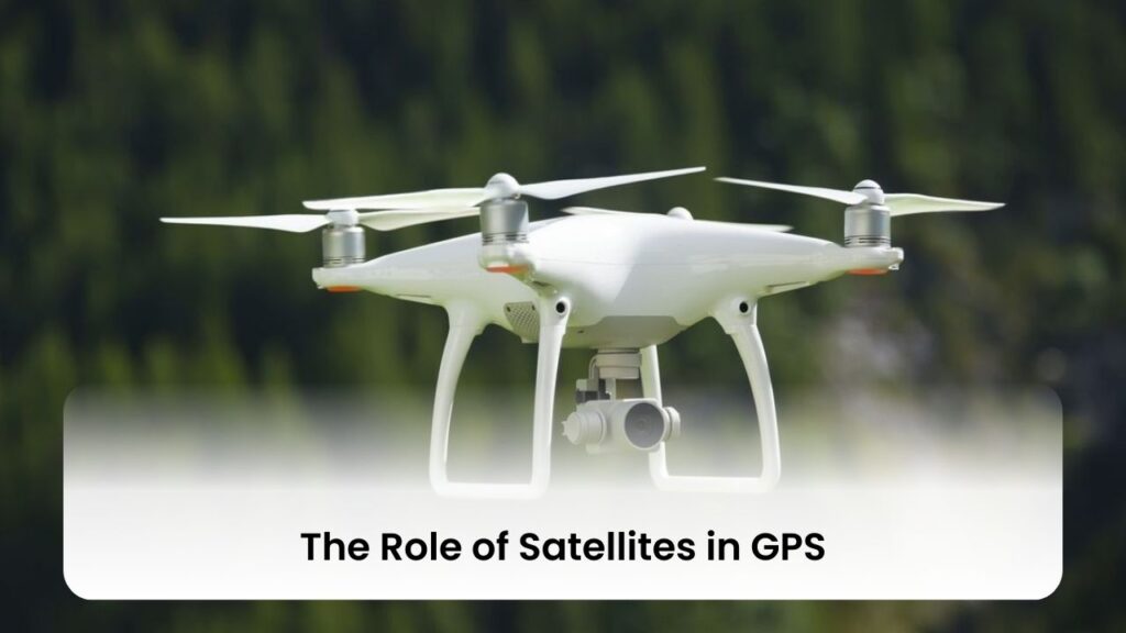
- The GPS satellite network consists of a constellation of at least 24 satellites, ensuring that at least four satellites are visible from any point on Earth at any time.
- These satellites orbit the Earth twice a day in a precise pattern, transmitting signal information to Earth, which is received by GPS devices.
- Each satellite carries a highly accurate atomic clock, helping to provide the exact time the signals are sent, which is crucial for determining a precise location.
GPS Signals and Receivers
- A GPS receiver calculates its distance from a satellite by measuring the time it takes for a transmitted signal to reach the receiver. This measurement is possible because the signal travels at a constant speed—the speed of light.
- To pinpoint an exact location on Earth, the GPS receiver must be in contact with at least four satellites, allowing it to calculate three dimensions: latitude, longitude, and altitude.
- Modern GPS receivers are highly sophisticated, capable of receiving signals from multiple satellite systems (such as GLONASS, Galileo, and Beidou) for even greater accuracy.
- The integration of GPS signals with local data sources, like internet connectivity, can refine accuracy, reducing errors and providing more precise location information.
Through the innovative use of satellites and the complex processing of GPS signals, GPS technology offers an indispensable tool for navigation and location tracking. Its application ranges from guiding drones across the sky to ensuring you find the quickest route to your next destination. As we continue to explore and rely on this technology, its potential to transform our understanding and interaction with the world around us grows ever more profound.
“GPS is the invisible thread that ties us to the rest of the world, guiding us through the unknown with the confidence of the stars themselves.”
GPS in Drones
The integration of GPS technology into drones has revolutionized how these flying machines operate, navigate, and perform tasks. From aerial photography and surveying to precision agriculture and search and rescue missions, GPS has made drones more versatile, reliable, and efficient. The ability of a drone to know its exact location, adjust to environmental changes, and even autonomously navigate to specific coordinates is largely thanks to GPS technology. In this section, we delve into how GPS is integrated with drone technology and explore the different types of GPS systems that drones use.
Integrating GPS with Drone Technology
- The integration of GPS into drone technology has enabled drones to achieve an incredible level of autonomy. Drones equipped with GPS can take off, navigate to multiple waypoints, and return home without any manual intervention.
- GPS in drones is not just about navigation. It also enhances stability and flight efficiency, allowing drones to compensate for wind and other environmental factors, and maintain a stable hover for aerial photography and videography.
- The use of GPS data combined with onboard sensors (like accelerometers and gyroscopes) enables precise tracking and movement, which is crucial for tasks that require high accuracy, such as mapping or agricultural spraying.
- For hobbyists and professionals alike, GPS has made drone flying more accessible and less daunting, opening up new possibilities for innovation and exploration.
Types of GPS Systems Used in Drones
Different GPS systems offer varying levels of accuracy and reliability. Understanding these differences is key to choosing the right drone for your needs or understanding the capabilities of your current drone.
Standard GPS vs. Differential GPS (DGPS)
- Standard GPS: This is the most common type of GPS used in consumer drones. It offers an accuracy of about 5 to 10 meters under open skies. While this is sufficient for general use, the precision might not meet the requirements for more specialized applications.
- Benefits include wide availability and relatively low cost, making it ideal for hobbyist and entry-level drones.
- Differential GPS (DGPS): DGPS improves the accuracy of GPS by using ground-based reference stations in addition to satellites. This system can correct some of the errors found in GPS signals, reducing position inaccuracies to within 1 to 3 meters.
- Especially useful in applications requiring greater precision, like surveying or precision farming.
Real-Time Kinematic (RTK) GPS
- RTK GPS takes the accuracy of drone navigation to another level. By using a fixed base station in conjunction with the drone’s GPS, RTK systems can achieve centimeter-level accuracy.
- This high precision is crucial for applications such as detailed topographic mapping, construction site management, and any other scenario where minute discrepancies matter.
- RTK-equipped drones are typically more expensive due to the advanced technology and the need for an additional ground-based reference station. However, for professionals requiring the utmost accuracy, the investment can be well worth it.
- The adoption of RTK GPS in drones represents the cutting edge of drone navigation technology, offering unprecedented precision and reliability.
GPS technology, through its integration into drone systems, has opened up a new world of possibilities. From the standard GPS systems that bring joy and utility to hobbyists, to the advanced DGPS and RTK systems that empower professionals with high precision, the impact of GPS on drone technology is profound. As this technology continues to evolve, we can only imagine the new heights that drones will reach, further transforming industries and hobbies alike.
“With GPS, drones become more than just eyes in the sky; they become our partners in reshaping the landscape of industries, making the old ways of doing things seem like using a map and compass in the age of smartphones.”
Precision Navigation Enabled by GPS
The Global Positioning System (GPS) has revolutionized many aspects of technology, but perhaps one of its most profound impacts has been on the world of drones. Through GPS, drones can navigate the skies with a level of precision that was once unimaginable. This technology allows for detailed flight planning, real-time adjustments, and a host of other benefits that enhance the capabilities of drones beyond just basic flight. Whether it’s for commercial use, hobbyist exploration, or critical missions like search and rescue, GPS-enabled drones are changing the game. Let’s delve into how drones use GPS for navigation and the advantages it brings to drone technology.
How Drones Use GPS for Navigation
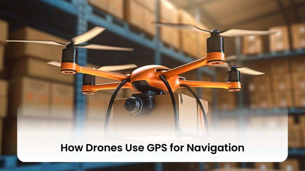
GPS is not just about finding a location on a map; it’s about providing drones with the intelligence to navigate the skies autonomously and efficiently.
Flight Planning and Control
- Pre-flight Planning: Operators can map out a drone’s flight path before takeoff by setting specific GPS waypoints that the drone will follow. This planning is crucial for missions requiring precise routes, such as surveying land or inspecting infrastructure.
- Adaptive Flight Control: GPS allows drones to adapt their flight path in real-time. If environmental conditions change or if there are obstacles in the planned route, the drone can adjust its path accordingly to maintain safety and efficiency.
- Automated Takeoff and Landing: With GPS, drones can be programmed to autonomously take off from and return to specific locations, reducing the risk of human error and ensuring the safety of the drone and its surroundings.
Real-time Positioning and Tracking
- Continuous Location Updates: GPS provides continuous updates on the drone’s location, allowing for real-time tracking and adjustments during flight. This capability is essential for maintaining the drone’s course and for operators to monitor its progress.
- Geofencing: This feature uses GPS to create virtual boundaries for the drone, preventing it from flying into restricted areas. It’s a safety measure that ensures drones operate within legal and safe parameters.
- Precision in Task Execution: Whether it’s capturing aerial photography or conducting environmental monitoring, real-time GPS tracking enables drones to perform tasks with high precision, ensuring quality results.
Advantages of GPS-Enabled Drones
The integration of GPS technology into drones has opened up a myriad of possibilities, enhancing their utility, safety, and efficiency.
Enhanced Stability and Accuracy
- Stable Hovering: GPS enables drones to hover in place with great stability, which is crucial for tasks that require precision, such as photography or surveillance.
- Accurate Positioning: With GPS, drones can pinpoint their exact location in the world, allowing for precise navigation and task execution. This accuracy is vital for many applications, including geological surveys and agricultural mapping.
Autonomous Flight Capabilities
- Self-directed Missions: Drones equipped with GPS can perform entire missions autonomously, following pre-set waypoints and adjusting as needed without direct control from an operator.
- Safety Features: Autonomous return-to-home functions are made possible with GPS, meaning drones can return to their starting point safely if they lose connection with the controller or if their battery runs low.
- Efficient Operations: The ability for autonomous flight allows drones to complete missions more quickly and efficiently, saving time and resources for operators.
The integration of GPS technology into drones represents a leap forward in how these devices are used across industries and hobbies. From enhancing safety to enabling autonomous operations, GPS has made drones more versatile, reliable, and indispensable tools in the modern world. As technology advances, we can only expect these capabilities to expand, opening new horizons for what drones can achieve.
“In the silent whisper of satellites, GPS speaks loudly in its guidance, turning the vastness of our world into a navigable path home.”
Practical Applications of GPS-Enabled Drones
Drones equipped with Global Positioning System (GPS) technology are not just flying gadgets; they are powerful tools that play a significant role in various industries. The precision navigation afforded by GPS has transformed drones into invaluable assets for tasks ranging from agriculture to emergency response. These applications not only demonstrate the versatility of drones but also how GPS technology enhances their efficiency and effectiveness. Let’s explore some of the practical applications of GPS-enabled drones and how they’re making a difference in our world.
Agriculture and Farming
The use of GPS-enabled drones in agriculture and farming represents a leap forward in how we approach food production and land management.
- Precision Agriculture: Drones can monitor crop health, moisture levels, and pest presence, allowing farmers to make precise interventions. This targeted approach conserves resources and increases yields.
- Land Mapping and Surveying: Farmers use drones to create detailed maps of their land. This information helps in planning crop rotation, irrigation systems, and land improvements.
- Livestock Monitoring: GPS-enabled drones can track the movement and health of livestock across large areas, improving herd management and preventing loss.
- Spraying and Planting: Drones equipped with spraying equipment can distribute fertilizers, pesticides, and even plant seeds with remarkable accuracy, thanks to GPS guidance.
Search and Rescue Operations
In search and rescue operations, every second counts. GPS-enabled drones have become critical tools in these high-stakes missions.
- Rapid Deployment: Drones can be quickly deployed to search vast areas much faster than ground teams or manned aircraft.
- Difficult Terrain Access: GPS navigation allows drones to safely navigate and search in rugged or inaccessible terrain, where time and safety are critical factors.
- Night Operations: Equipped with thermal imaging, drones can continue search operations at night, with GPS ensuring they stay on course.
- Locating Individuals: Drones can relay precise GPS coordinates of found individuals to rescue teams, speeding up the rescue process.
Geographic Mapping and Surveying
The accuracy and efficiency of geographic mapping and surveying have been significantly enhanced by the use of GPS-enabled drones.
- High-Resolution Mapping: Drones capture detailed aerial images that are used to create high-resolution maps and 3D models of landscapes and structures.
- Environmental Monitoring: Scientists and researchers use drones to monitor changes in ecosystems, track wildlife, and assess the impact of climate change.
- Land Use Planning: Urban planners and developers rely on drone surveys to plan infrastructure projects, zoning, and land development.
- Archaeological Exploration: Drones are used in archaeology to map and explore historical sites without disturbing the terrain.
Infrastructure Inspection and Management
Inspecting and managing infrastructure becomes more efficient and safer with GPS-enabled drones.
- Utility Inspections: Drones inspect power lines, wind turbines, and pipelines, identifying maintenance needs without putting workers at risk.
- Structural Health Monitoring: Engineers use drones to assess the condition of bridges, buildings, and other structures, enabling timely repairs and maintenance.
- Construction Site Management: GPS-enabled drones provide aerial views of construction sites, tracking progress, and ensuring projects stay on schedule.
- Disaster Assessment: After natural disasters, drones quickly assess damage to infrastructure, guiding repair efforts and aiding in disaster recovery.
GPS-enabled drones are reshaping industries by providing efficient, accurate, and safer methods for tasks that were once challenging and resource-intensive. As drone technology continues to advance, we can expect even more innovative applications that will further benefit society.
“The true power of GPS-enabled drones lies not in the technology itself, but in their ability to touch lives, to reach where humans can’t, and to do so with the assurance of a compass always pointing north.”
Challenges and Limitations
While GPS-enabled drones have transformed numerous sectors by offering precise navigation and a multitude of practical applications, they are not without their challenges and limitations. These issues range from technical constraints like signal loss to broader societal concerns such as privacy. Understanding these hurdles is essential for both users and developers of drone technology, as it guides the improvement of systems and the development of regulations. Here’s a closer look at some of the key challenges and limitations associated with GPS-enabled drones.
GPS Signal Loss and Interference
GPS technology, though widely reliable, can face disruptions that affect drone performance.
- Signal Blockage: Urban environments, dense forests, or deep valleys can block GPS signals, leading to signal loss. This can disrupt a drone’s navigation and operational capabilities.
- Interference: Signals from electronic devices or other sources can interfere with the GPS. This interference can cause inaccurate positioning or, in worse cases, loss of control.
- Spoofing and Jamming: Malicious attacks in the form of spoofing (sending false GPS signals) or jamming (blocking GPS signals) pose serious risks, potentially diverting drones from their intended paths.
- Mitigation Strategies: Technologies like multi-GNSS receivers, which use signals from multiple satellite systems, and the integration of backup navigation systems (e.g., inertial navigation systems) can mitigate these risks.
Legal and Privacy Concerns
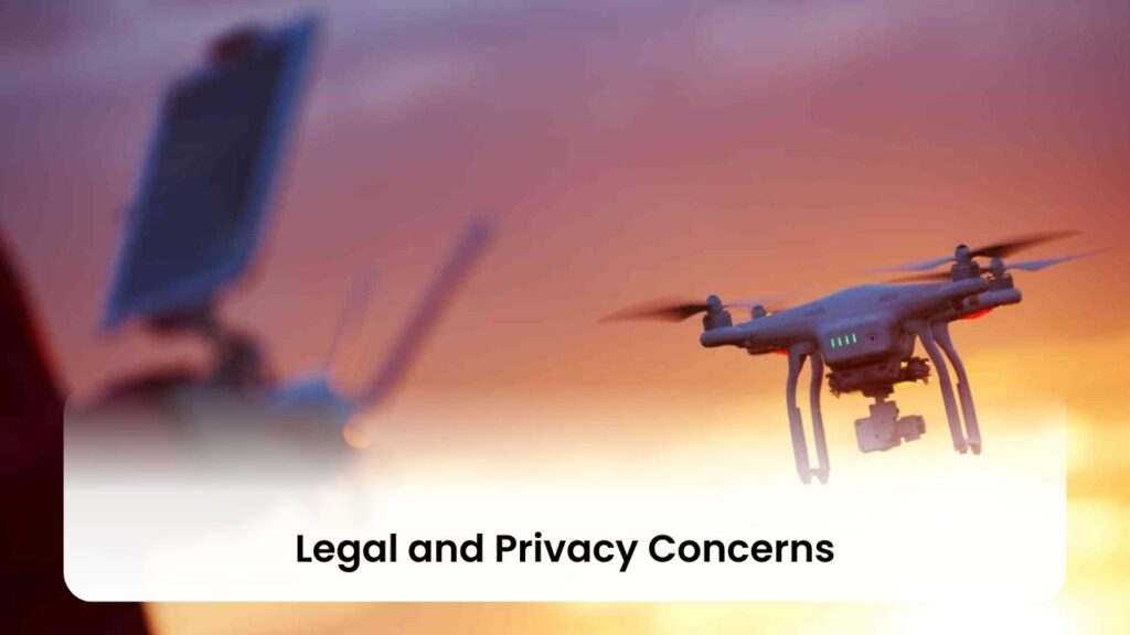
The increasing use of drones has raised significant legal and privacy issues that need addressing.
- Regulatory Compliance: Drone operators must navigate a complex landscape of regulations that vary by country and region. These rules often pertain to where drones can fly, how high they can go, and what purposes they can be used for.
- Privacy Invasion: Drones equipped with cameras and GPS can easily capture images and videos of private properties, leading to concerns over privacy invasion. This has spurred debates on the ethical use of drones and the need for privacy safeguards.
- Legal Frameworks: Many countries are developing or updating legal frameworks to balance the benefits of drone technology with privacy rights and safety concerns. These include rules on data collection, storage, and sharing.
- Public Awareness and Trust: Educating the public about the purposes and benefits of drone technology, along with transparent operation practices, can help build trust and alleviate privacy concerns.
Reliance on GPS: Risks and Mitigations
Heavy reliance on GPS for drone navigation comes with its own set of challenges.
- Dependency: Over-reliance on GPS can be problematic in environments where GPS signals are unreliable. Drones must be able to operate safely even when GPS is compromised.
- Alternative Navigation Systems: Developing and integrating alternative navigation technologies, such as vision-based navigation (using cameras and sensors to perceive the environment) and LiDAR, can reduce dependency on GPS.
- System Redundancy: Implementing redundant systems in drones, where critical components like GPS receivers have backups, can ensure continued operation if one system fails.
- Continuous Research and Development: Ongoing research into improving GPS technology and drone resilience is essential. This includes enhancing signal processing, exploring new forms of navigation, and developing robust anti-jamming techniques.
While GPS technology has undeniably advanced the capabilities of drones, addressing these challenges and limitations is crucial for the future development and application of drone technology. Innovations in navigation systems, alongside thoughtful regulation and public dialogue, will help ensure that drones continue to serve society in positive and impactful ways.
“Navigating the sky is not just about mastering the technology of GPS but about understanding the clouds of regulations, privacy concerns, and the occasional storm of public opinion that can obscure its path.”
The Future of GPS and Drone Technology
The integration of GPS into drone technology has not only revolutionized current practices but also paved the way for exciting future developments. As we look forward, it’s clear that continuous innovation in GPS technology and the expanding capabilities of drones are set to redefine what’s possible. From enhanced accuracy to autonomous operations, the future of GPS and drone technology holds promising advancements that will further impact industries, improve societal services, and open up new horizons for hobbyists and professionals alike. Let’s explore some of the anticipated innovations in GPS technology, emerging trends in drone navigation, and the transformative role of AI and machine learning.
Innovations in GPS Technology
The evolution of GPS technology is geared towards overcoming current limitations and unlocking new possibilities for drone operations.
- Enhanced Precision: Future GPS systems aim to provide even greater accuracy, reducing errors to mere centimeters. This precision will be crucial for complex navigation tasks and precision agriculture.
- Improved Signal Reliability: Research is focused on enhancing signal strength and reliability, particularly in challenging environments such as urban canyons or dense forests where signal loss currently poses significant challenges.
- Resilience to Interference: New developments are expected to bolster GPS systems’ resilience against interference and spoofing, ensuring reliable navigation even in adverse conditions.
- Integration with Other Technologies: GPS technology is set to be more seamlessly integrated with other navigation and communication technologies, creating more robust and versatile navigation systems for drones.
Emerging Trends in Drone Navigation
As drone technology evolves, so too do the methods and systems used for navigation, promising more autonomy and efficiency.
- Beyond Visual Line of Sight (BVLOS) Operations: Advances in GPS and drone technology are making BVLOS flights more feasible, allowing drones to operate safely over longer distances and in more complex environments.
- Indoor Navigation: While GPS is a staple for outdoor navigation, emerging trends include the development of systems for precise indoor navigation, opening up new applications for drones in warehousing, emergency response, and more.
- Swarm Drones: GPS advancements will facilitate the coordination of drone swarms, enabling multiple drones to operate in concert for tasks like aerial light shows, large-scale surveys, and even search and rescue missions.
- Global Expansion: As GPS technology becomes more accessible and reliable, drone navigation capabilities will expand globally, including in regions currently limited by weak GPS signals or infrastructure.
The Role of AI and Machine Learning
AI and machine learning are set to play pivotal roles in the future of drone navigation, enhancing the capabilities of GPS-enabled drones beyond current limits.
- Autonomous Decision Making: AI will enable drones to make real-time navigation decisions, optimizing routes, avoiding obstacles, and adapting to changing conditions without human intervention.
- Predictive Maintenance: Machine learning algorithms will predict maintenance needs based on flight data and GPS tracking, minimizing downtime and extending the lifespan of drone fleets.
- Enhanced Data Processing: AI and machine learning will improve the processing of data collected by GPS-enabled drones, allowing for quicker and more accurate analysis of large datasets for mapping, surveying, and inspection tasks.
- Learning Environments: Drones will be able to learn from each flight, improving their navigation capabilities over time through machine learning, thus becoming increasingly efficient and adaptable to new tasks and environments.
The future of GPS and drone technology is bright, filled with the promise of further innovations that will enhance the precision, safety, and utility of drones. As these advancements come to fruition, drones will play an even more integral role in our lives, driving progress across a myriad of applications and industries.
“As we stand on the brink of new horizons, GPS and drone technology together hold the key to unlocking worlds within and beyond our own, charting a course not just across the sky, but towards the future itself.”
Conclusion
The Future Skyward Journey with GPS and Drones As we’ve journeyed through the intricacies of GPS technology and its integral role in drone navigation, it’s clear that the synergy between these two marvels of modern engineering is not just transformative but also indicative of future advancements. The horizon for GPS and drone technology is vast and promising, with potential that stretches from the precision in agricultural practices to the lifesaving capabilities in search and rescue missions. As we continue to innovate and refine these technologies, the sky is not the limit but the beginning of a new era of possibilities.
FAQs
Q.How does GPS enhance drone navigation?
GPS technology enhances drone navigation by providing accurate location data, enabling drones to fly precise routes, adjust to environmental conditions, and perform autonomous operations like takeoff and landing with minimal human intervention.
Q.What types of GPS systems are used in drones?
Drones utilize various GPS systems, including Standard GPS for general use, Differential GPS (DGPS) for improved accuracy, and Real-Time Kinematic (RTK) GPS for centimeter-level precision, catering to diverse needs from hobbyist explorations to professional applications.
Q.Can drones navigate without GPS?
While GPS significantly enhances drone navigation, drones can also utilize alternative systems like vision-based sensors or inertial navigation systems (INS) for areas where GPS signals are weak or unavailable, ensuring operational versatility.
Q.What are the practical applications of GPS-enabled drones?
GPS-enabled drones serve numerous applications across industries, including precision agriculture, search and rescue operations, geographic mapping and surveying, infrastructure inspection, and environmental monitoring, demonstrating their versatility and impact.
Q.What challenges do GPS-enabled drones face?
Despite their advancements, GPS-enabled drones face challenges like signal loss in dense environments, potential interference or spoofing, regulatory and privacy concerns, and a dependency on reliable GPS signals for optimal operation, highlighting the need for continuous innovation and regulation.