
LiDAR, or Light Detection and Ranging, is a remote sensing technology that uses laser light to measure distances by analyzing reflected pulses, providing high-resolution data across challenging terrains1. The advent of integrating LiDAR technology with drones has revolutionized the field of aerial mapping and surveying, making it possible to capture detailed 3D maps and models that can penetrate dense vegetation to reveal the true topography beneath2. This drone with LiDAR combination offers unparalleled advantages over traditional surveying methods, enhancing accessibility, efficiency, and resulting in cost savings3.
These advancements have wide-ranging applications across various industries, including surveying and construction, conservation and forestry, utility and power lines, agriculture, archaeology, and mining, marking a significant leap in how landscapes are mapped and understood4. This article will delve into how drones equipped with LiDAR technology are transforming terrain mapping with unprecedented detail, covering their synergy, technological advancements, benefits, and the diverse applications that these mapping drones enable5.
Drones and LiDAR Technology
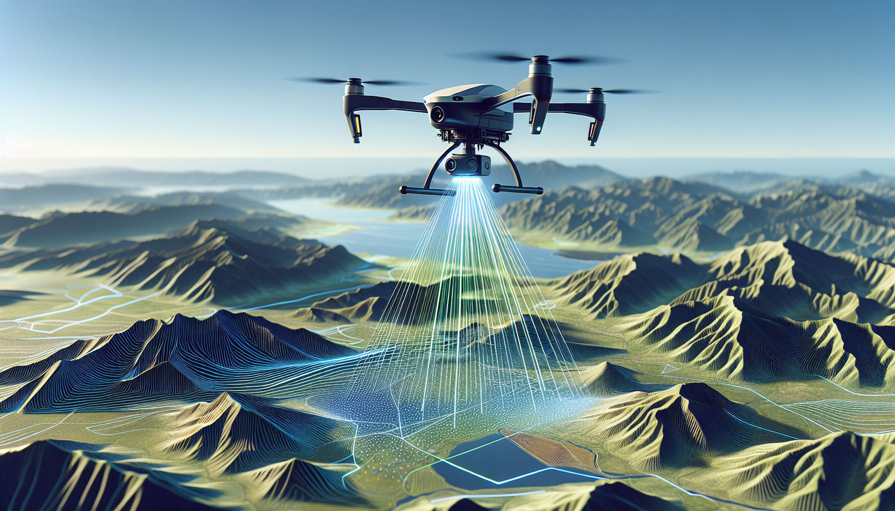
Understanding the intricate relationship between drones and LiDAR technology unveils how this synergy is reshaping the landscape of aerial mapping and surveying. Let’s delve into the components and functionalities that make this combination a cornerstone in precision mapping.
- LiDAR Technology Explained:
- LiDAR, or Light Detection and Ranging, is a form of remote sensing that uses laser light to measure distances. It operates by emitting laser pulses and calculating the time taken for these pulses to return after hitting a surface 7.
- The core components of a LiDAR system on a drone include a LiDAR sensor, a Global Navigation Satellite System (GNSS), an Inertial Measurement Unit (IMU), and a recording system. These components work in tandem to capture millions of data points per second, creating detailed 3D representations of the Earth’s surface 78.
- Drones as Platforms for LiDAR:
- Drones, also known as Unmanned Aerial Vehicles (UAVs), serve as versatile platforms that can be equipped with LiDAR sensors. This combination allows for the collection of high-fidelity data across various terrains, including remote or hard-to-reach areas 2.
- Notable examples of LiDAR drones include the DJI L1, which offers survey-grade accuracy and the ability to penetrate dense foliage, and the Elios 3 by Flyability, designed for indoor inspections. These drones demonstrate the range of applications and versatility that LiDAR-equipped UAVs offer 51.
- Advantages and Applications:
- The integration of LiDAR technology with drones brings several benefits, including precision, efficiency, safety, and minimal environmental impact. These advantages make drone-LiDAR mapping highly sought after in industries such as construction, agriculture, forestry, and archaeology 4.
- In practical terms, LiDAR drones are utilized for tasks like creating detailed 3D models, mapping eroded shorelines, investigating accidents, and even uncovering hidden archaeological sites. Their ability to capture accurate and detailed terrain points revolutionizes how we understand and interact with the physical world 14.
This exploration into drones equipped with LiDAR sensors illuminates their transformative role in various industries, driven by the precision and detail they offer in mapping and surveying tasks.
Read More: Drone Swarms: Coordinated Flight for Enhanced Capabilities
The Synergy Between Drones and LiDAR
Drones equipped with LiDAR technology significantly enhance the efficiency and accessibility of mapping and surveying tasks. This synergy between drones and LiDAR technology has been instrumental in transforming terrain mapping, offering several notable advantages:
- Precision and Detail:
- LiDAR-equipped drones generate millions of data points that accurately represent the earth’s surface and features above it, creating detailed 3D maps and models. This level of detail is crucial for various applications, from construction planning to environmental conservation 10.
- The ability to “see” through vegetation with LiDAR technology allows for the mapping of the true topography of the land beneath, which is particularly beneficial in areas with dense foliage where traditional methods fall short 911.
- Versatility and Efficiency:
- The combination of drones and LiDAR technology is not limited by lighting conditions, unlike traditional photogrammetry methods. This allows for data collection at almost any time of day, under various weather conditions, enhancing the efficiency of mapping projects 9.
- Drones equipped with LiDAR can be deployed in hard-to-reach places, from rugged mountainous terrains to dense forests, offering versatility in exploration and data collection that was previously unattainable with ground-based survey methods 2.
- Applications Across Industries:
- The transformative impact of drone LiDAR mapping is evident across various industries. For instance, in agriculture, it aids in the precise measurement of land, contributing to better crop management and yield prediction. In archaeology, it reveals hidden structures beneath vegetation, opening new doors to understanding historical sites without disturbing the ground 2.
- Implementation examples include Microdrones’ range of drone LiDAR systems like mdLiDAR3000LR and mdLiDAR1000HR, which are tailored for different scales of projects, demonstrating the technology’s adaptability to diverse industry needs 12.
This synergy between drones and LiDAR technology marks a significant step forward in the way we collect and analyze geographical data, offering a blend of precision, efficiency, and versatility that propels various industries into a new era of mapping and surveying capabilities.
Read More: Emerging Trends in Drone Design and Materials
Advancements in LiDAR Technology
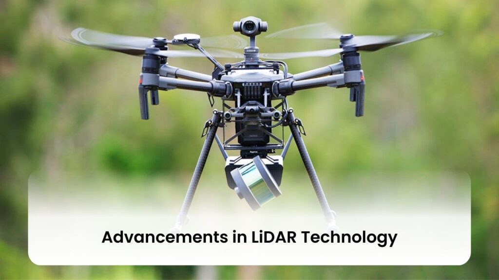
Advancements in LiDAR technology have propelled its integration into various sectors, making it a cornerstone for innovation in drone applications and beyond. Here are some pivotal enhancements:
- Miniaturization and Consumer Integration:
- LiDAR technology is now being integrated into consumer electronics, marking a significant leap towards everyday applications. This includes obstacle avoidance and terrain mapping in drones, fall detection systems for the elderly, and augmented reality (AR) applications in smartphones 13. The miniaturization of LiDAR systems not only broadens their application spectrum but also enhances their functionality in compact devices.
- Technological Enhancements:
- Solid-State LiDAR: Represents a breakthrough with its no-moving-parts design, offering lower production costs, reduced maintenance needs, and improved durability and reliability 13.
- Enhanced Resolution and Distance Detection: Modern LiDAR sensors boast higher resolution and the capability to detect objects from longer distances, a critical feature for safety and navigation in advanced driver-assistance systems (ADAS) and autonomous driving 13.
- AI and Machine Learning Integration: The fusion of LiDAR with artificial intelligence (AI) and machine learning technologies enables sophisticated object recognition, scenario analysis, and real-time data processing. This integration allows LiDAR systems to classify objects, predict movement patterns, and make informed decisions based on collected data 13.
- Economic and Industrial Impact:
- The LiDAR market is witnessing robust growth, valued at USD 2.14 trillion in 2023 and projected to reach USD 5.32 trillion by 2028. This growth is fueled by economies of scale, advancements in manufacturing technology, and the mass production of LiDAR systems at reduced costs, democratizing access to LiDAR technology across industries 13. Companies like Hesai Technology are leading the charge, offering a range of lidar solutions suited for various applications, including ADAS and near-range blind spot detection. Strategic partnerships with automotive OEMs and Tier 1 suppliers have secured numerous design wins for Hesai’s solid-state lidar products in multiple series production vehicle programs, further establishing lidar’s role in the automotive sector 14.
These advancements underscore the evolving landscape of LiDAR technology, highlighting its increasing accessibility, affordability, and application across a myriad of industries. With ongoing innovations, LiDAR continues to redefine precision mapping and surveying, offering a glimpse into a future where its applications are as diverse as they are transformative.
Read More: The Role of Sensors and Cameras in Modern Drones
Benefits of Using Drones with LiDAR
Drones equipped with LiDAR technology bring a multitude of benefits across various industries, significantly enhancing the efficiency, safety, and quality of data collection processes. Here are some of the key advantages:
- Efficiency and Cost-Effectiveness:
- Time and Cost Savings: Automating the data collection process with drones and LiDAR technology significantly reduces the time required to cover large areas, leading to substantial cost savings 3.
- Large Area Mapping Capabilities: Drones with LiDAR can map extensive areas quickly, offering a practical solution for projects requiring detailed terrain data over vast regions 3.
- Safety and Accessibility:
- Enhanced Safety: By employing drones, areas that are difficult or dangerous to access for ground-based surveys can be easily reached, minimizing the risk to survey teams 3.
- Versatility in Data Collection: The ability to capture data from various angles and altitudes not only enhances the safety of operations but also improves the detail and quality of the output 3.
- Accuracy and Precision:
- High Accuracy Levels: Drone LiDAR systems are known for their high accuracy, typically within a few centimeters, making them ideal for applications requiring precise measurements such as topographic mapping and infrastructure inspection 318.
- Improved Data Quality: The detailed data captured from different perspectives ensures superior quality, aiding in more accurate modeling and analysis for projects across agriculture, construction, emergency response, and more 318.
Moreover, the integration of LiDAR with UAVs is paving the way for innovative applications in construction, agriculture, mining, and other sectors, driven by the growing demand for geospatial data and the increasing accessibility of drone technology 19. This, coupled with the enhanced navigational capabilities of drones equipped with LiDAR, underscores the transformative potential of this technology in mapping, surveying, and inspection tasks 3.
Read More: The Evolution and Future of Drone Battery Technology
Applications Across Industries
Drone with LiDAR technology has revolutionized data collection and analysis across a broad spectrum of industries, offering precise, efficient, and safe solutions for a variety of applications. Here’s a closer look at how different sectors are leveraging this advanced technology:
- Surveying and Construction: Drones equipped with LiDAR are instrumental in creating detailed 3D models of construction sites, monitoring project progress, and ensuring that designs are accurately brought to life. They are used for topographic surveys, 3D modeling, and the inspection of existing structures, facilitating project planning and execution 22.
- Agriculture and Forestry: In agriculture, drones with LiDAR technology optimize resource management by pinpointing areas for water, fertilizer, and pesticide application, thus improving crop yield. Forestry benefits from the ability to measure canopy structures and density, aiding in land management, environmental impact assessments, and fire prevention planning 17.
- Mining and Quarrying: The mining sector utilizes LiDAR drones for several critical operations, including monitoring stockpile volumes, conducting site safety inspections, and mapping extensive mining areas. This not only enhances operational efficiency but also significantly reduces safety risks for personnel 24.
- Infrastructure and Utilities: LiDAR drones play a pivotal role in the inspection and maintenance of critical infrastructure, such as power lines, pipelines, and cellular towers. They enable precise mapping and inspection from safe distances, minimizing the need for human exposure to hazardous conditions 22.
- Archaeology and Cultural Heritage: The technology has opened new frontiers in archaeological research, especially in dense jungles where traditional methods are impractical. LiDAR-equipped drones can reveal hidden structures beneath vegetation, providing invaluable data without disturbing the site 10.
- Disaster Management and Emergency Response: In the aftermath of natural disasters, drones with LiDAR can quickly map affected areas, assess damage, and aid in the planning of effective response strategies. This capability is crucial for saving lives and mitigating further damage 3.
- Environmental Monitoring and Conservation: LiDAR drones are used for mapping erosion, monitoring wildlife habitats, and managing water resources. They offer a non-invasive method to gather detailed environmental data, supporting conservation efforts and sustainable management practices 4.
- Urban Planning and Smart Cities: As cities grow and evolve, drones with LiDAR technology aid in urban planning by providing detailed data for infrastructure development, traffic management, and the optimization of public services 23.
This multifaceted applicability of drones with LiDAR technology underscores its transformative impact across industries, driving advancements in operational efficiency, safety, and data accuracy.
Read More: Artificial Intelligence in Drones: Enabling Autonomous Operations
Case Studies: Successful Drone-LiDAR Mapping Projects
- Land Mine Clearance: The HALO Trust utilized UAV LiDAR technology to enhance land mine clearance planning. This application highlights how drones equipped with LiDAR can be used in humanitarian efforts, providing safe and efficient ways to plan mine clearance activities in affected regions 27.
- Utility and Power Line Management:
- Routescene UAV LiDAR System: Proved to be superior for powerline vegetation management, enabling utility companies to maintain clearances and prevent outages 27.
- Fortis: Employed a LiDAR mobile mapping system to upgrade outdated copper distribution lines, showcasing the technology’s utility in enhancing infrastructure resilience 27.
- Rekon Solutions: Conducted a transmission line survey with UAV LiDAR, highlighting the application’s importance in maintaining critical infrastructure 27.
- Environmental and Archaeological Surveys:
- Forest Management: UAV LiDAR technology facilitated forest canopy structure characterization by UW-Madison, demonstrating the value of point cloud data in managing and preserving forest ecosystems 27.
- Arctic Tundra Study: Vegetation shifts and the release of greenhouse gases were studied using UAV LiDAR, illustrating the technology’s role in climate change research 27.
- Chernobyl Forest Mapping: Thirty years post-explosion, Routescene UAV LiDAR mapping technology was employed to map the Chernobyl forest, providing insights into the environmental recovery and impacts of such disasters 27.
- Alderney Archaeological Survey: An archaeological survey on Alderney in the Channel Islands utilized Routescene UAV LiDAR System and data processing software, showcasing the technology’s capability to uncover historical insights without disturbing the site 27.
- Mapping Ancient Structures: UAV LiDAR technology was used to identify 750-year-old structures in the Canyons of the Ancients National Monument, demonstrating its utility in preserving cultural heritage 27.
- WWI Monument Documentation: Glasgow School of Art captured a WWI monument in the United States using drone LiDAR, highlighting the technology’s application in historical preservation 27.
- Innovative Applications:
- Agriculture: Innovair, a Scottish-based survey and inspection service company, utilized LiDAR forest mapping to protect the next generation of ancient trees, underlining the technology’s importance in sustainable agriculture and forestry 27.
- Disaster Management: UAV LiDAR technology was employed in hard-to-reach, hazardous areas like landslides for accurate mapping, illustrating its critical role in emergency response and disaster management 27.
- Conservation Efforts: UAV LiDAR systems are used to locate, identify, and preserve old trees, demonstrating the technology’s contribution to environmental conservation 27.
These case studies underscore the versatility and impact of drone with LiDAR technology across various sectors, from enhancing safety and efficiency in industrial applications to contributing to environmental conservation and archaeological discoveries.
Read More: Quantum Computing and Drones
Challenges and Solutions
While drone with LiDAR technology offers transformative capabilities in mapping and surveying, it also presents several challenges that require innovative solutions to maintain the efficiency and accuracy of data collection. Addressing these challenges involves a combination of technological advancements, operational strategies, and skilled personnel.
Technological and Operational Solutions:
- Wind Resistance and Weather Conditions:
- High wind resistance drones and weather monitoring systems can mitigate the impact of adverse weather, ensuring stable and accurate data collection even in challenging conditions 28.
- For extreme weather conditions where drones cannot operate, integrating drone data with ground-based mapping systems like RTK GPS or traditional LiDAR can ensure continuous data collection 28.
- Transportation and Accessibility:
- Utilizing compact and lightweight drones simplifies transportation to remote or difficult-to-access sites, enabling broader operational capabilities 28.
- Advanced navigation systems and GPS-stabilized drones enhance the ability to navigate large or unusual sites, overcoming obstacles such as tall buildings and trees 28.
- Site Terrain and Accessibility:
- Drones equipped with a post-processed kinematic (PPK) module increase accuracy in partially or totally inaccessible areas, ensuring high relative and absolute precision in the resulting models 30.
- For sites with difficult terrain, hybrid drones that combine the endurance of fixed-wing drones with the vertical takeoff and landing capabilities of multicopters offer a practical solution 30.
Training, Regulation, and Data Management:
- Expertise and Regulations:
- Comprehensive training programs for personnel ensure the safe and effective operation of drones and LiDAR systems, addressing the knowledge gap and enhancing operational safety 31.
- Navigating regulatory and legal concerns requires staying informed about local, state, and federal regulations, facilitating compliance and improving the regulatory environment through collaboration and advocacy 29 31.
- Data Processing and Accuracy:
- Developing effective drone data workflows and utilizing specialized software for data processing can streamline the handling of large datasets, minimizing errors and optimizing data accuracy 29 31.
- Implementing tips for optimizing data accuracy, such as using a GNSS reference station and minimizing hardware mounting errors through boresight alignment calibration, ensures the collection of high-quality data 7.
By addressing these challenges through technological enhancements, operational adjustments, and a focus on training and compliance, organizations can maximize the benefits of drone with LiDAR technology. This approach not only improves the efficiency and accuracy of mapping and surveying tasks but also expands the potential applications of this technology across various industries.
Future Trends in Drone-LiDAR Mapping
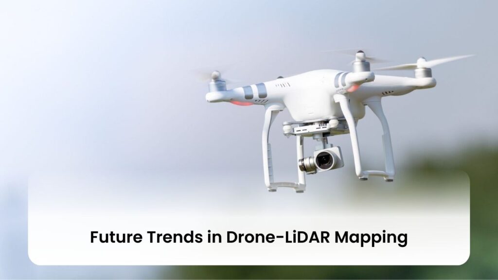
The future of drone-LiDAR mapping is poised for significant growth and innovation, driven by advancements in technology and supportive regulatory frameworks. The anticipated trends in this evolving field include:
- Market Growth and Segmentation:
- The global LiDAR drone market is on a trajectory to reach US$ 892.0 million by 2032, showcasing a Compound Annual Growth Rate (CAGR) of 15.9% through 2033 18. Concurrently, the Drone LiDAR Mapping System Market is expected to achieve US$207.8 million by 2032, with a steady CAGR of 8.9% from 2023 to 2029 24. This growth is underpinned by the increasing demand for precise and efficient mapping solutions across various industries.
- Market segmentation reveals a diversification in product types, with Rotary-Wing LiDAR Drones and Fixed-Wing LiDAR Drones catering to different operational needs and applications 24. Geographic segmentation encompasses major regions including North America, Europe, Asia-Pacific, South America, and the Middle East and Africa, highlighting the global demand and adaptation of drone-LiDAR technology 24.
- Regulatory and Collaborative Developments:
- Progressive laws and regulations by governments worldwide are crucial in supporting the advancements and applications of drone-LiDAR technology. These regulatory frameworks are designed to ensure safety, privacy, and efficiency in operations, fostering a conducive environment for technological innovation 19.
- Enhanced collaboration is anticipated among professionals from various fields such as surveyors, engineers, municipalities, and architects. This interdisciplinary approach aims at harnessing drone-LiDAR technology for more efficient data collection, analysis, and application in projects that span across different industries 21.
- Technological Innovations and Applications:
- Automation and machine learning are gaining prominence, emphasizing the need for efficient data processing and the management of larger volumes of data. These technologies are crucial in refining the accuracy, speed, and reliability of data analysis, paving the way for more sophisticated applications of drone-LiDAR mapping 21.
- The field of drone surveying and 3D mapping is continuously evolving, with new developments expected to emerge. Innovations such as the integration of LiDAR with photogrammetry data collection are tailored to specific applications, offering flexibility and enhanced results based on project requirements 8. Additionally, considerations for Beyond Visual Line of Sight (BVLOS) operations are influencing drone platform choices, with Routescene recommending different drone platforms based on payload, flight performance, and the type of drone needed 8.
These trends underscore the dynamic nature of the drone-LiDAR mapping industry, highlighting the potential for growth, regulatory evolution, collaborative efforts, and technological advancements. As the industry moves forward, these factors will play a pivotal role in shaping the future landscape of drone-LiDAR mapping, offering promising opportunities for enhanced precision, efficiency, and applicability across a broad spectrum of industries.
Explore More Categories:
Conclusion
Throughout this article, we have explored the transformative synergy between drones and LiDAR technology, highlighting their unprecedented precision and efficiency in terrain mapping across a multitude of industries. From the enhanced data collection capabilities that span agriculture, archaeology, construction, and beyond, to the significant advancements in technology that make these innovations accessible and impactful, it is clear that drones equipped with LiDAR sensors are redefining the landscape of aerial surveying and mapping. The case studies presented exemplify the practical applications and benefits of this synergy, demonstrating its potential to revolutionize data collection methods and contribute to various sectors in meaningful ways.
As we look towards the future, the potential for further advancements in drone-LiDAR technology is vast, promising even greater accuracy, efficiency, and applicability. The evolving regulatory frameworks and continuous technological innovations suggest a bright future for this field, one where drones and LiDAR technology continue to play a crucial role in shaping industries by providing detailed and precise data like never before. For those engaged in these sectors or interested in the possibilities of aerial surveying and mapping, the journey of drones and LiDAR technology is one to watch closely, as it continues to unfold new landscapes of opportunity and innovation.
FAQs
- What are the top LiDAR drones and sensors for mapping and surveying?
- Garmin LiDAR-Lite v3: A compact, high-performance optical distance measurement sensor 1.
- LeddarTech Vu8: Offers long-range detection capabilities for various applications 1.
- RPLIDAR A2M8 360° Laser Scanner: Provides 360-degree scanning capability, ideal for obstacle avoidance and navigation 1.
- Velodyne HDL-32E: Known for its rich data capture, making it suitable for intricate mapping needs 1.
- Velodyne Puck VLP-16: A compact solution that delivers detailed 3D data for both indoor and outdoor use 1.
- How does the accuracy of LiDAR drones impact surveying results?
- Microdrones’ mdLiDAR3000 solutions offer an impressive accuracy of 1-3 cm in x, y, and z dimensions, while the mdLiDAR1000 system achieves an accuracy of 5 cm in the same dimensions. This level of precision is crucial for applications requiring detailed measurements, such as construction site mapping and infrastructure inspection 1112.
- Equinox Drones utilize professional surveying drones like the DJI Phantom Pro 4, achieving 1cm level accuracy in surveying results. This high degree of spatial presentation, known as Ground Sampling Distance (GSD), is pivotal for creating high-resolution orthomosaics and comprehensive 3D representations 32.
- What are the diverse applications of drone technology beyond mapping?
- Agriculture: Drones flying at heights of 50-100m are used for crop scanning, spraying, and health assessment, with multispectral cameras aiding in crop, soil, and irrigation management 32.
- Livestock Monitoring: Employed for overseeing cattle farming, ensuring the security of farms and animals 32.
- Stockpile Management: UAVs offer a cost-efficient, accurate, and reliable solution for managing stockpiles in construction, mining, and other industries 32.
- Disaster Management: Drones are instrumental in mapping hazardous areas, such as landslides, for accurate and safe disaster management 27.
- Environmental Conservation: Utilized for locating, identifying, and preserving old trees, highlighting the technology’s contribution to conservation efforts 27.
References
[1] – https://www.flyability.com/lidar-drone [2] – https://www.yellowscan.com/knowledge/lidar-drone/ [3] – https://www.microdrones.com/en/content/drone-lidar-faqs-and-advantages-with-microdrones-and-geocue/ [4] – https://www.jouav.com/blog/lidar-drone.html [5] – https://enterprise-insights.dji.com/blog/lidar-equipped-uavs [6] – https://geoslam.com/blog/2023/03/30/what-is-lidar-drone/ [7] – https://www.youtube.com/watch?v=xS4kOWcoDPY [8] – https://www.routescene.com/resources/uav-lidar-frequently-asked-questions/ [9] – https://advexure.com/blogs/news/lidar-and-drones-a-new-era-in-topographical-mapping-surveying [10] – https://consortiq.com/uas-resources/lidar-and-drone-uses [11] – https://www.microdrones.com/en/content/ten-questions-about-drone-lidar/ [12] – https://www.microdrones.com/en/content/top-questions-about-drone-lidar/ [13] – https://knowhow.distrelec.com/internet-of-things/top-5-hottest-trends-in-lidar-technology-right-now/ [14] – https://finance.yahoo.com/news/advancements-solid-state-lidar-technology-120010217.html [15] – https://www.electronicsforu.com/technology-trends/latest-lidar-systems [16] – https://www.hesaitech.com/the-future-of-lidar-technology-growth-opportunities/ [17] – https://blog.cloudfactory.com/interesting-lidar-applications [18] – https://thedronecentre.ae/exploring-the-benefits-of-lidar-drone-systems-a-comprehensive-guide/ [19] – https://hokuyo-usa.com/application/files/2516/9272/3924/Hokuyo-USA-LiDAR-Q3-Whitepaper_1.pdf [20] – https://geocue.com/resources/categories/case-studies/ [21] – https://www.rockrobotic.com/post/survey-says-7-drone-surveying-3d-mapping-industry-predictions-trends-for-2023 [22] – https://flyguys.com/5-industry-use-cases-for-lidar/ [23] – https://www.linkedin.com/pulse/lidar-drone-market-top-applications-virk-prashan-fqyuf [24] – https://www.linkedin.com/pulse/drone-lidar-mapping-system-market-trends-3qocc [25] – https://www.microdrones.com/en/news/case-studies/ [26] – https://wingtra.com/case_studies/ [27] – https://www.routescene.com/case-studies/ [28] – https://www.linkedin.com/pulse/challenges-using-drones-mapping-mohamed-shawky [29] – https://www.commercialuavnews.com/surveying/6-barriers-to-drone-adoption-in-surveying-mapping-and-how-to-overcome-them [30] – https://www.gim-international.com/content/article/five-challenges-when-selecting-drones-for-mapping [31] – https://www.mdpi.com/2504-446X/7/3/202 [32] – https://www.equinoxsdrones.com/faq-page/